
Major Rivers in Isiolo


The Mighty and Invaluable Ewaso Nyiro River
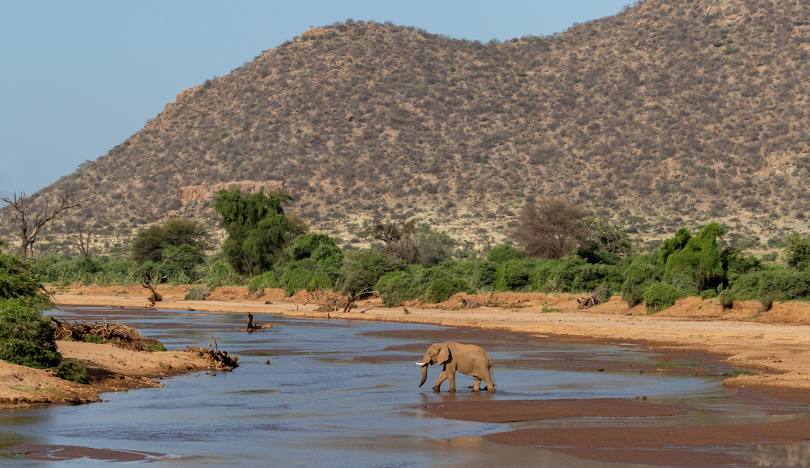
The drainage pattern Isiolo County is dominated by the Ewaso Nyiro River, which often flows when all other rivers are dry thanks to high rainfall at its headwaters in Mount Kenya and Aberdare Ranges. It has reached the stage of early maturity, for although flowing quickly, its course meanders via a wide belt of its own alluvium. When tributary streams reach the alluvium they often flow along its edge instead of cutting directly to the main river. The flow of Ewaso Nyiro River diminishes east of Merti Plateau, owing of evaporation, before terminating in the Lorian Swamp.
All rivers flowing within Isiolo County, excepting the Tana, are a part of the Ewaso Nyiro drainage pattern. River Tana flows in the southern area demarcating its short boundary with Tana River County. Rising from the western slopes of Mount Kenya, the mighty Ewaso Nyiro, traversing seven semi-arid counties on its 700 km course to the Lorian, is the major lifeline for the people, livestock, and the swag wildlife. It dissects Isiolo County into two: To the north of the river is the Merti Plateau and to its south are the wildlife rich plains lying at an altitude of 1,000 ms asl. Further north, River Ewaso Nyiro is crossed nearby Archer’s Post.
Kenya is blessed with several rivers, each playing a vital role in the country’s ecosystem, economy, and culture. The longest of these is the Tana, stretching approximately 1,000 kilometers from its source in the Aberdare Mountains to the Indian Ocean. Long, wide, short, seasonal, the rivers that crisscross Kenya each contributes to the natural beauty, biodiversity, and socio-economic success.
Index of The Longest Rivers in Kenya


River Tana - approx. 1,000 km: rising in Mount Kenya and Aberdare Ranges and draining into Indian Ocean; Ewaso Nyiro - approx. 700 km: rising in Mount Kenya and draining into the Lorian Swamp; Daua River - approx. 450 km; rising in the Sidamo Highland (through Ethiopia and Kenya) and draining into the Somali Sea; The Mara River - approx. 395 km, formed in Bomet County, after the Nyangores and Amala River merge, it drains into Lake Victoria, and is thus a tributary to the Nile River; Athi-Galana-Sabaki - approx. 390 km; rising in the Aberdare Ranges and draining into Indian Ocean; Mara River - approx. 380 km; rising in the Mau Escarpment and draining into Lake Victoria; Kerio River - approx. 350 km; rising in the Tugen Hills and draining into Lake Turkana; Turkwel River - approx. 340 km; rising in Mount Elgon and draining into Lake Turkana; River Nzoia - approx. 257 km: rising in the Cherangani Hills and draining into Lake Victoria; Southern Ewaso Nyiro - approx. 220 km; rising in the Mau Escarpment and drains into Lake Natron; River Yala - approx. 219 km; rising in the Nandi Escarpment and draining into Lake Victoria; Gucha River - approx. 190 kms: rising in the Kiabonyoru Hills in Nyamira County and draining into Lake Victoria; River Nyando - approx. 153 km: rising in the Mau Escarpment and draining into Lake Victoria

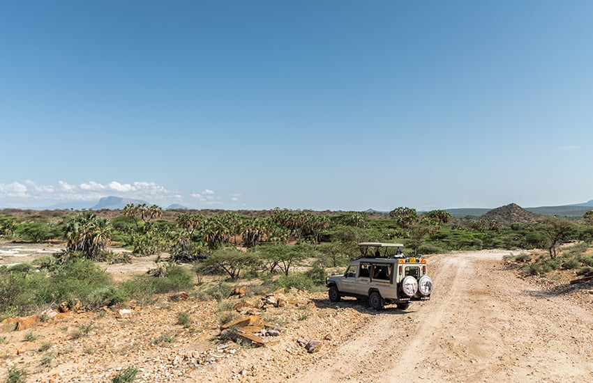
Isiolo County, with its strategic location, rich cultural heritage, and potential for development, is a unique region in Kenya. It features a mix of semi-arid and arid landscapes, with some areas of savannah and bushland, and home to several wildlife reserves and conservancies, including the Buffalo Springs National Reserve, Shaba National Reserve and the famed Lewa Wildlife Conservancy.
You Are Here: Ewaso Nyiro River
Where to Next?
Explore Destination Nearby Ewaso Nyiro River
A Guide to Isiolo County


A Summa Digest of Isiolo

About Isiolo Way Back When

42 Destinations in Isiolo County, arranged as one would visit these - south, north, east then north - with aid of narratives, images, strip maps and distance chart:

Isiolo Town, St. Eusebius Cathedral, Isiolo Jamia Mosque, Isiolo Memorial, Kisimani Eco Resort, Isiolo Falls, Kaita and Degushi Hills, Nyambeni Range, Magado Crater, Cave Dwellings, Harr Girrissa, Mlima Tatu, Kubi Turkana, Garba Tula, Gotu Falls, Gotu Cultural Centre, Biliqo Bulesa Conservancy, Merti Plateau, Merti Catholic Church, Ewaso Nyiro River, Lorian Swamp, Malka Cultural Centre, Bisanadi National Reserve, Kora Wells, Leparua Conservancy, Ol Lentille Conservancy, The Sanctuary at Ol Lentille, Oldonyiro Conservancy, Nantudu Spire Rock, Nasuulu Conservancy, Buffalo Springs National Reserve, Buffalo Springs, Samburu National Reserve, Samburu Simba Lodge, Shaba National Reserve, Sarova Shaba Lodge, Joy’s Camp, Nakuprat Gotu Conservancy, Boji Dera Camp, Sera Conservancy, Isiolo Cultural Festival, Camping in the Great North

Know More About Isiolo County: Its Geography, Land-Use, Highlights, Population, Roads - with the aid of strip maps, Airports, Climate & National Monuments

What’s The Air Like In Isiolo?
Isiolo is almost always hot and dry at most months of year, with a mean of 30oC, and two rainy seasons. The rainfall received is historically erratic, scarce and unreliable.


What’s The Lay Of The Land In C.11?
Isiolo can be split into three ecological zones, semi-arid, arid and very near desert arid. The smallest, useful, semi-arid zone covers only 5% the county, around Kinna region.
