
The Gainful Breadbasket
A Summa Digest of Trans Nzoia County
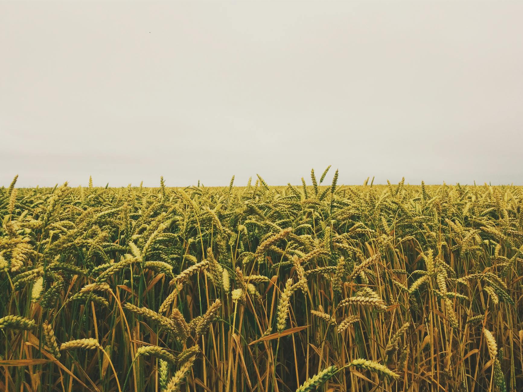
Resembling a rough outline of a rectangle or a doodled trapezium, in the extreme Western Kenya bordering Uganda, Trans Nzoia County, well-known as a gainful breadbasket of Kenya is, generally speaking, a flattened country only undulating gradually towards Mount Elgon at the top left corner. Interestingly, the area gets drier as one travels westerly towards Mount Elgon on account of the rain shadow of this mountain, modifying this quarter to a livestock-barley region. Geologically, Trans Nzoia is a continuation of the Uasin Gishu Plateau beyond (Trans) the Nzoia River (Nzoia). It is comparable economically and culturally to Uasin Gichu County.
As it happens, these two counties share many other aspects, including a share of the Cherangani Hills – in Trans Nzoia County situated at the bottom-right corner. The Cherangani Hills rise sharply to heights of over 9,000 ft and in consequence rainfall is much higher here than in most parts of both counties. The comparison extends, too, to the socioeconomics. Trans Nzoia County, like Uasin Gishu, is best-known as the cornerstone of large scale farming in Kenya. Any journey across the counties, year-round, takes you deep into picturesque and verdant horizons, and across some of the most beautiful farmlands you’ll ever set eyes upon in Kenya.
The spectacular panoramic sweeps of vast patchwork of maize, sunflower, tea, and coffee estates are, without doubt, Nzoia’s doted-on heritage. Being mainly agricultural in character no mineral so far, apart from the constructional material, have been worked in this region. Its capital, Kitale, a bustling town known for its agricultural trade and proximity to major hubs, with several major roads radiating in and out, connecting the four corners, is a nexus of communication and trade. It borders Bungoma to the west, Uasin Gishu and Kakamega to the south, Elgeyo Marakwet to the east, West Pokot to the north, and Uganda to the northwest.
The primary roads within Trans Nzoia County are fairly good and they traverse through the main towns of Kitale and Endebess and thereafter running north before finally terminating in Suam River Bridge at the Kenya-Uganda border. The primary line of communication is the A1 Kisumu-Kitale-Lodwar Road, traversing the county with a northwest strike. A secondary road, B2 Eldoret-Kitake-Suam Road, traverses it with a northeast strike intersecting with the A1 at Kitale town. Work has begun on the Kapchorwa-Suam Road which links Suam to Uganda.
The county has a population of diverse ethnicities, including the Luhya, Kalenjin, and Bukusu. Swahili and English are widely spoken, alongside local languages. Mout Elgon National Park and Saiwa Swamp National Park are the main focus of interest. The climate, thanks to its elevations and presence of Mount Elgon and Cherangani Hills is temperate, with average daytime temperatures ranging from 23°C to 29°C and nighttime temperatures ranging from 11°C to 14°C. Annual rainfall ranges from 1,000 mm to 1,700 mm. The average elevation in Trans Nzoia County is 1,800 ms above sea level, but it rises to 4,313 ms above sea level at Mt. Elgon.
Salient Features of Trans Nzoia County
- County Number 26
- Area – 2496 km2
- Altitude – 1800 to 2000 ms
- Major Towns – Kitale, Endebess, Kiminini
- Borders – Kakamega, West Pokot, E. Marakwet, Uasin Gishu, Bungoma
Trans Nzoia County is a vital region for Kenya’s agricultural and ecological balance. Its rich history, cultural diversity, and natural beauty make it a unique and valuable part of the Rift and Western Kenya. The county’s potential for growth remains immense, particularly in agriculture, tourism, and environmental conservation.
You Are Here: Trans Nzoia County
Where to Next?
Explore Destinations in Trans Nzoia County
A Guide to Trans Nzoia County


A Summa Digest of Trans Nzoia

About Trans Nzoia Way Back When

30 Destinations in Trans Nzoia County, arranged as one would visit these - south, west then north - with aid of in-depth narratives, images, strip maps and distance chart:

Mount Elgon National Park, Koitoboss Peak Hike, Wagagai Peak Hike, Chesurur Falls, Kitum Cave, Macking’eny Cave, Ngwarisha Cave, Endebess Bluff, Chepnyalil Cave, KWS Koitoboss Guesthouse, Kapkuro Bandas, Mount Elgon Lodge, Suam Gorge, Mt. Elgon Orchards, Mount Elgon Guesthouse, Kamariny Cave, Kitale Plains, Kitale War Memorial, Kitale Museum, Kitale Club, Treasures of Africa, Kitale Nature Conservancy, Sirwo Resort, Cranes Haven, Saiwa Swamp National Park, Tree Top Hut, Kapolet Fishing Camp, Kapcherop Forest, Cheranganis, Barnley’s Guest House, Kaisagat Hill

Know More About Trans Nzoia: Its Geography, Land-Use, Highlights, Population, Roads - with the aid of strip maps, Airports, Climate & National Monuments

What’s The Lay Of The Land in C.26?
Trans Nzoia can be split into three definitive ecological zones: Upper Highland Zone, Upper Midland Zone, and the Lower Highland Zone. These zone lie between 4,313 m in Mount Elgon to 1,700 ms asl.
What’s The Air Like in T. Nzoia?
Trans Nzoia has a highland equatorial type of climate. Rainfall is well distributed throughout the year, the higher areas in the west receiving more. Average annual temperature is 24oC.

