
The Best of Everywhere


A Summa Digest of Tana River County
Located in the southeastern part of the country, covering a vast area of 35,375 km2, Tana River County is typified by contrasting landscapes, including riverine ecosystems with deltas, coastal plains, savannah grasslands, and semi-arid areas. It has great natural beauty and lovely cultural heritage, with massive potential for touring, making it the best of everywhere. It takes its name from the considerable presence of Tana River, Kenya’s longest. Flowing from the central highlands to the Indian Ocean, it is the prominent geographical feature around Tana River County.
From its origination on the Aberdares and the snows of Mount Kenya to its end of the line, debouching into the Indian Ocean, Tana River flows for 1000 km. From the headwaters it first flows east, then north, almost reaching the equator, before it takes a sweep round and proceeds just east of south on a long and undeviating southerly course skirting the eastern border of Tana River County. The ensuing flood plain, varying in width from 2 to 4 km, forms the foundation of purpose.
Along its course, Tana River provides a valuable swathe of land for farming and dry season grazing. Tana’s importance for generating hydro-electric power and sustaining the livelihoods of hundreds of thousands living along the invigorating river banks are clearly and inextricably linked. Bearing on the presence of the Tana river, the county is the best of everywhere ecologically, well observable in the ranging ecological gamut, from savannah to coast. The most striking ecologies in Tana River County are the epic River Tana Delta and the untravelled 72 km coast.
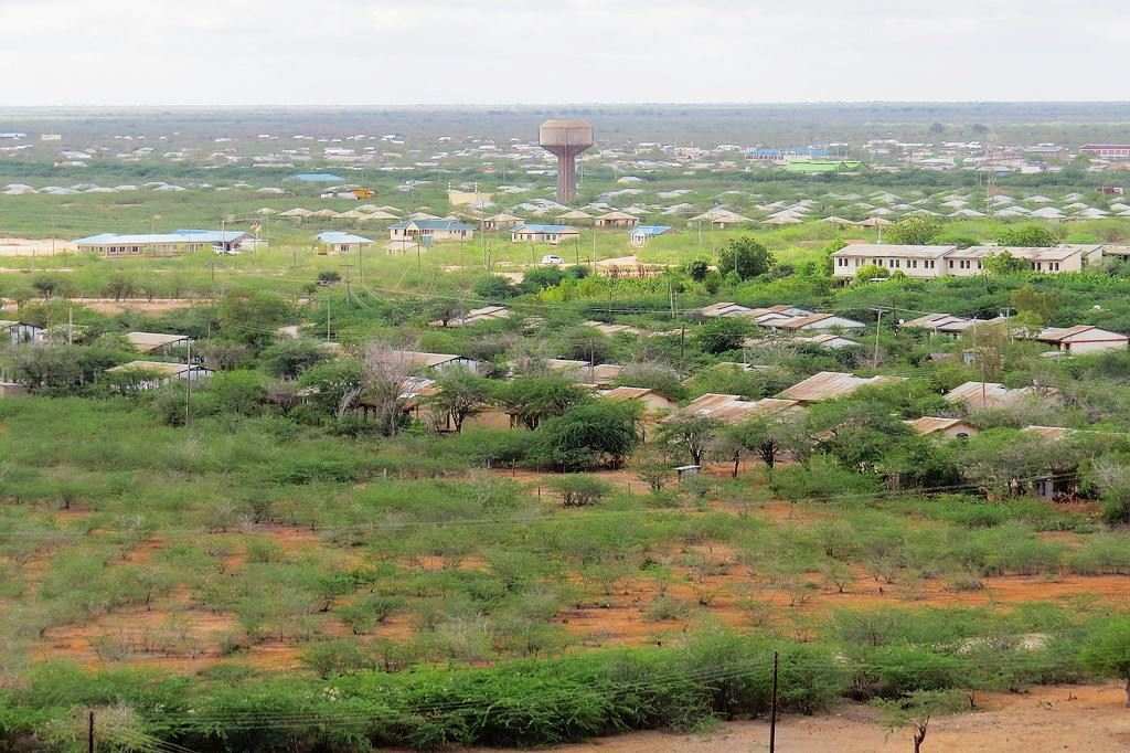
Not counting Tana River there are several small rivers more proper laghas flowing in a west to east course from Kitui and Makueni counties – all draining into Tana River. Still and all, much of the county is semi-arid with little land use. Pokomo, noted as the main community, survive, on exiguous subsistence, farming along River Tana insomuch as the minority Orma and Wardei tribes are pastoralists habitually on the move in search of water and pasture. The pastoralist community makes up 56% of its population. Correlative of their vocation is that poverty in Tana River stands at 77%, making it one of the least developed Counties of Kenya.
While there is a link between the poverty and the view of the colonial system towards the Northern Frontier of which Tana River County was a part of, nearly 96% of its land surface area lies in the coastal lowland typified by low erratic rain, just 400mm yearly. To make gain on the large tracts of land, the idea of ranching was tested, in 7 ranches: Wachu, 307 km2, Kibusu, 250 km2, Haganda, 120 km2, Kitangale, 200 km2, Idasa Godana, 510 km2, Giritu, 433 km2 and Kondertu, 200 km2. But of these only Idasa Godana could be said to be productively active.
The principal line of communication in Tana River County is the north to south oriented B8 Mombasa-Malindi-Garissa Road – through Garsen, Hola and Bura. This runs just 30 km outside the eastern boundary for 347 km from Garissa to Karawa near Malindi. The second road, a bit more engaged, connecting the B8 Malindi-Garissa Road with the A3 Thika-Liboi Road at Garissa, traverses it west to east for 70 km across the northern area. Both these roads travel astride the north and east border limits across a beautiful country, athwart being an unsung circuit.
Owing to the low rainfall and practice of overgrazing with both cattle and goats the vegetal profile over much of Tana River County is mainly of the thick thorn bush type with restricted grassland, except for the riverine areas marked by an abundance of greenery and woodland. The ground slopes away southwards with a few low hills. Beneath the silence of the semi-arid county is a mute gospel of the mighty African sun. Yet, strike out every suggestion of penury and the experience across the lesser travelled B8 Road, invariably smooth and peaceful across the stark landscape, commonly sunny, is a thrilling and unexacting drive to the Coast.
Salient Features of Tana River County
- County Number 04
- Area – 38,862 km2
- Altitude – 6200 ft
- Major Towns – Hola, Madogo, Galole, Bura
- Borders – Kitui, Garissa, Isiolo, Lamu, Kilifi

Tana River County is a rewarding destination for travelers interested in exploring off-the-beaten-path locations in Kenya. River Tana is the longest river in Kenya, flowing through the county and offering opportunities for riverine activities such as boat cruises, fishing, and birdwatching. Tana River County is home to the Orma and Pokomo ethnic groups, each with rich cultural traditions, music, and dances.
You Are Here: Tana River County
Where to Next?
Explore Destinations in Tana River County
A Guide to Tana River County


A Summa Digest of Tana River

About Tana River Way Back When

28 Destinations in Tana River County, arranged as one would visit these - north to south - with the aid of narratives, images, strip maps and distance chart:

Ngao Neukirchen Church, Lake Shakababo, Delta Dunes Lodge, Ozi Conservation Area, Tana River Lodge, Old Town Kipini, Ungwana Bay Ruins, Shaka Ruins, Mwana Ruins, Fumo Liyongo Shrine, Kipini Conservancy, Red Cliff Camp, River Tana Delta, Tana Delta Colonial Forts, Tana Delta Cultural Centre, Tana Primate National Reserve, Mchelelo Bandas, Ndera Conservancy, Mau Mau Hola Monument, Hola Methodist Church, Bura St. Jude, Bura Irrigation Scheme, Bura East Conservancy, Arawale National Reserve, George Adamson's Grave, Kora National Park, Adamson's Fall, Tana River Bridge

Know More About Tana River County: Its Geography, Land-Use, Highlights, Population, Roads - including a distance chart, Airports, Climate & National Monuments

What’s The Air Like In T. River?
Tana River has a hot and dry climate with average annual temperatures of 30oC; the highest,41oC, is in January-March and the lowest being 20o C in June-July. Rainfall is low, bi-modal, and erratic.


What’s The Lay Of The Land In C.04?
The land generally sloping eastward, Tana River is all undulating plain that is only interrupted in a few places by low hills – at Bilibil and Bura.
