
Geography, Land-Use, Highlights, Population, Roads, Airports, Climate & National Monuments in Nandi County
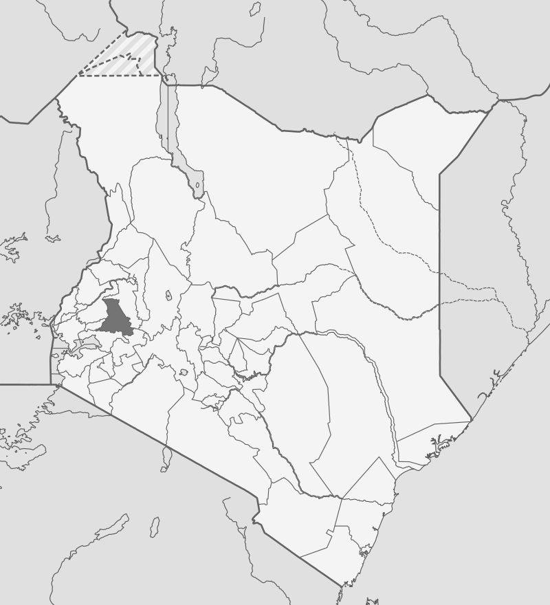


Geography of Nandi County
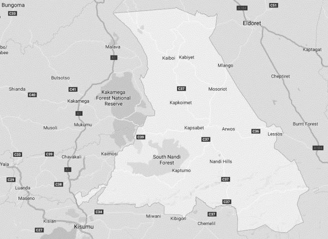
Generally speaking, Nandi County is comprised of five well-defined topographic zones: rolling hills, Kapsabet Plateau, Tinderet Volcanic mass, King’wal Swamp and Nyando Escarpment. The area around Kapsabet Plateau is an agriculture hub, lying at 2,020 ms asl, comprised of an undulating hills crossed by various rivers including Kipkaren, Kimondi and Birei. In a like manner, the Tinderet Highlands, a major agricultural region, has several rivers making their way across the deeply incised valleys, to include; Kipkurere, Kibos, and Kundos. Unique to Tinderet is the craggy landscape, which in some places has rocks jutting out to heights of 2,500 ms. Furthermore, some of these rivers produce substantial waterfalls and rapids that have potential for harnessing hydroelectric power. Still, in craggy disposition is the Nyando Escarpment, comprised of extremely rugged terrain that consists of granites and volcanic rocks. The Equator runs alongside Nyando’s scarp-line.
Land Use in Nandi County
Forests in Nandi County form 13% of its land cover. The North and South Nandi Forest Reserves occurring at an altitude below 1,900 ms (ASL) bear significant differences to the North Tinderet Forest Reserve which occurs between 2,300 to 2,500 ms ASL. The North Nandi Forest is an extension of the Kakamega Forest, typified by high rainfall and diverse species of trees. These forests are composed of indigenous hardwoods. Some of the other forests at Kimondi and Serengonik collectively comprise of about 2,636-hectares of exotic forest plantations. Most of the remaining areas of Nandi are put under crop cultivation – for subsistence and commercial use. The main food crops produced in Nandi County are maize, beans, cow peas, potatoes and cabbages, covering a total of 1257 km2. The main cash crops are tea, coffee, and sugar cane. The cash crop covers about 263 km2.
Highlights in Nandi County
Nandi County has upwards of 66 identified tourist sites – nature based tourism, agro, sports, eco-tourism and cultural – scattered across the county, which to a large extent have not been fully developed to attract visitors. Some of the tourist products and attraction sites in the county include; Nature Based tourism, Agro tourism, Sports tourism, Eco tourism and Cultural tourism. The main National Reserve in Nandi is the Bonjoge National Reserve in Nandi South. Other key attractions in Nandi County are; its famed Nandi Rock and South Nandi Forest.
Population in Nandi County
In 2009, Nandi County had a population of about 813,803 made up of 406,907 males and 406,896 females. The most densely populated constituency was at Emgwen, with a buff population density of 400 persons/km2. Correspondingly, Tinderet was the least densely populated constituency then, with a population density of 201 persons/km2. At present, Nandi’s inter-censual growth rate stands at 3.1 %, which is slightly higher than the national growth rate of 3.0%. A majority of the residents reside in the rural areas given that a big percentage of the county is rural. Only 3.9% of the entire population resides in urban centres. Kapsabet, its largest, is the most populous town, followed by Nandi Hills Town.
Airports in Nandi County
Nandi County does not have any airstrips. In instead, Nandi County depends on airports in the neighbouring Counties of Uasin Gishu, Kisumu, and Kakamega.
Roads in Nandi County
Nandi County has roughly 183 kms of tarmac road, out of a 1,673 kms total road network. Many and then some of the unpaved roads are in bad condition, more so over the rainy season, hindering effective access. The poor state of the roads is accentuated by the heavy rainfall – which is experienced throughout the year.
Climate in Nandi County
Nandi County has a pleasurable and moderate warm climate year long with no cold and hot extremes. The climate is influenced by both altitude and geology. Most parts of Nandi County experience mean temperatures betwixt 18o C to 22o C during the rainy season; except for the area adjacent to Nyando Escarpment which at a lower altitude of 1,300 ms experiences warmer temperatures, as high as 26 C. In the dry months – December and January – the mean temperature in Nandi County is 23o C. However, during the cold spell between July and August night temperatures drop to as low as 14oC. Generally speaking, Nandi receives an average rainfall of 1200 mm to 2000 mm yearly. The long rains start in early March and continue up to end of June, while short rains start in mid September and end in November. Only rarely is there a month without some rainfall. The perceived dry spell is usually experienced from end of December to mid-March.
National Monuments in Nandi County
There are no designated national monuments in Nandi County.

You Are Here: Nandi County
Where to Next?
Explore Destinations in Nandi County
A Guide to Nandi County


A Summa Digest of Nandi

About Nandi Way Back When

40 Destinations in Nandi County, arranged as one would visit these - south, north then west - with the aid of in-depth narratives, images, strip maps and distance chart:

Londiani-Koru Route, Nyando Escarpment, Bonjoge National Reserve, Nandi Rock, South Nandi Forest, Tindinyo Falls, Karebe Gold Mining, Nandi Scarp, North Nandi Forest, Tabolwa Rock, Kabiyet Shrine, Cheruiyot Ecosystem, Nandi Hills, Chepsangor Coffee, Koitalel Samoei Museum, Samiitui Aldai Stone Historic Site, Nandi Bears Club, Ketbarak Viewpoint, Kip’s Eco-Resort, Kapsimotwa Gardens, The Sheu Morobi Cliffs, Chemase Waterfalls, Mberere Holy Springs, Kopere Rocks, Songhor Prehistoric Site, Tinderet Forest, Diguna Waterfalls, Ngabunat Caves Falls, Kiplolok Springs, Kapsabet, Kaptumo and Kipture Forts, Eden Springs Hotel, Keben Springs, Kingwal Wetland I Sitatunga Conservancy, Chepkiit (Mlango) Falls, Kamulat (Ndalat) Hill, Kapchemuriet

Know More About Nandi County: Its Geography, Land-Use, Highlights, Population, Roads - including a distance chart, Airports, Climate & National Monuments

What’s The Air Like in Nandi?
Nandi County has a fine and moderate warm climate year long with no cold and hot extremes. Nandi’s climate is influenced by both altitude and geophaphy. Most areas experience temperatures of between 18o C and 25o C.


