
Adventurous Drives in Muranga
C70 Gacharage-Kangema Road: Nyoka-Nyoka
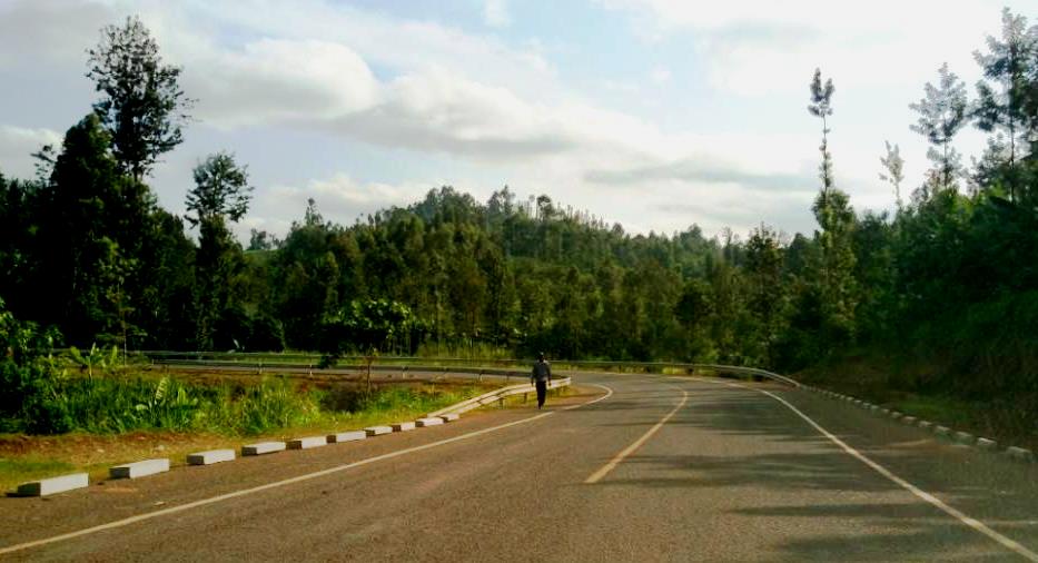
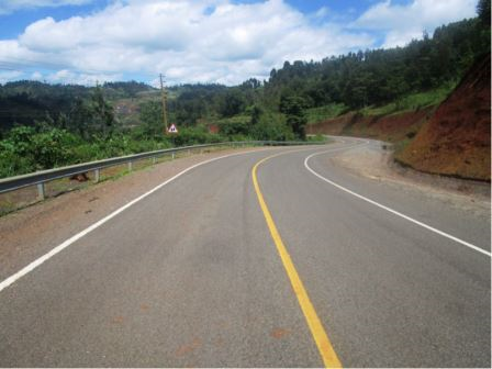
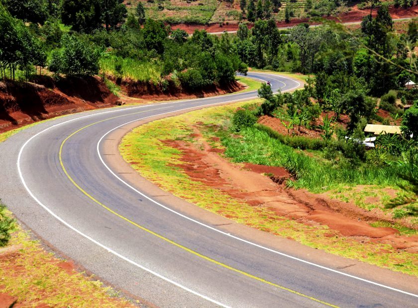
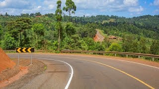
North to south the roads above, over, and across Kenya’s Great Rift Valley are winding, offering spectacular drives through a wildy-scenic country with no few example than the road radiating out of Mai Mahiu, Iten, Nyaru and Kabarnet. Much the same in the Central Highlands are the roads about the Aberdare Range, which is an extension of the Great Rift Valley. As we now know, the developed roads in the western region of Muranga County in proximity to the Aberdare Range are winding, steeply looping through the hills, and perfect for an adventurous drive.
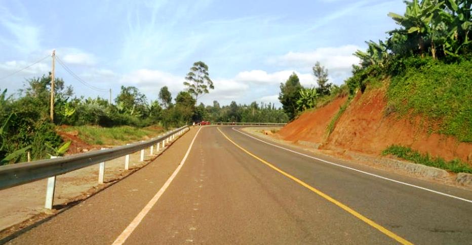
If, from Ndakaini Dam, at the southeastern corner of Muranga County, joining the Kangema-Gacharage Road, you drive out for 27 km northerly heading, through Gatiani to Gacharage, you’ll arrive shortly at the starting-point of infamous C70 Gacharage-Kangema Road, aptly dubbed Nyoka-Nyoka. A snaking 35 km jaunt considered one of the best driving thrills in Muranga County. It runs northerly heading through Kahuti, Gatuya, Muriranjas, Kagaa, Marumi, Kariua and ends at Kangema. While its obligatory to note that it must have been strenuous and back-breaking for engineers to lay its black top, it is an absolute joy for the motorists.
By design, the two lane strip of blacktop, creasing and hugging the saddle of hills all the way, is meant to make the idea of traveling across the region more attractive. On any given weekend, tens of motorists head out from Nairobi to Muranga in search of this nostalgic drive. In recent times, the newly completed C70 section between Gacharage and Kangema has become the darling of many off-beat tailgating driving tours eke-named as the Muranga Tourist Trophy (TT).

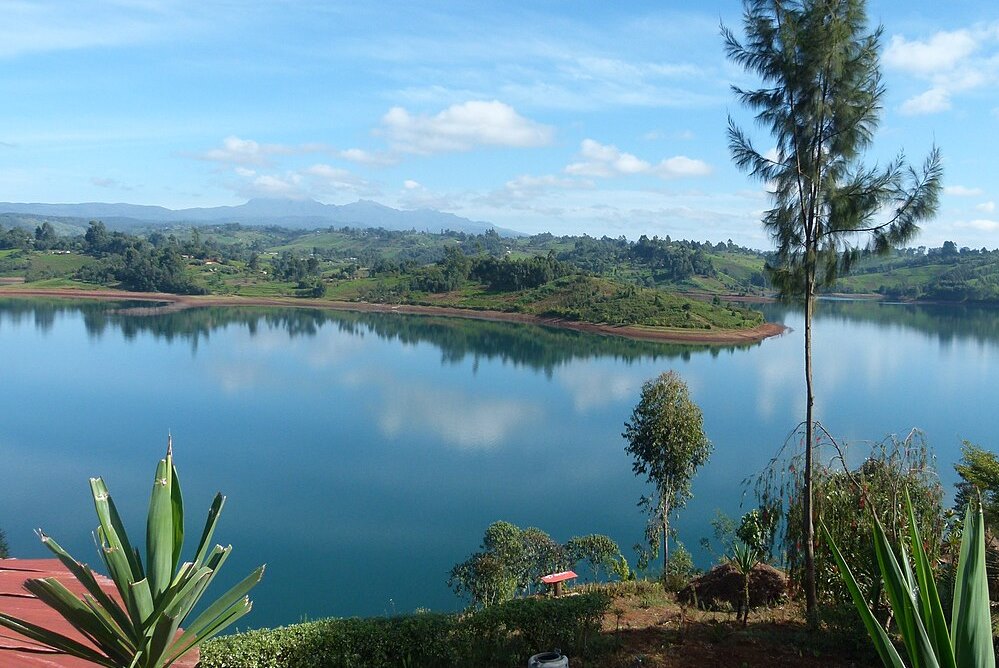
Murang’a County is a rich agricultural and cultural hub, known for its historical significance, beautiful landscapes, and important role in Kenya’s tea and coffee industries. The scenic hillscapes and cultural heritage makes Murang’a County a fascinating destination for visitors interested in nature, history, and agriculture.
You Are Here: C70 Gacharage-Kangema
Where to Next?
Explore Destinations Nearby C70 Gacharage-Kangema
A Guide to Muranga County


A Summa Digest of Muranga

About Muranga Way Back When

40 Destinations in Muranga County, arranged as one would visit these - south, north, west then east - with aid of narratives, images, strip maps and distance chart:

Gatura Greens Purple Tea Farm Tours, Kimakia Tea Cottage, Kimakia Falls, Kanunga Falls, Ndakaini Dam, Ndakaini Dam Marathon, Muchiri's Resort, Aberdare Forest, Elephant Hill, Aberdare Bongo Ecolodge, Ranges View Lodge, Manguyo Falls, Mathioya River, Kenya Fly Fishers (Southern Camp), Aberdare Cottages and Fishing Lodge, Mathioya River Lodge, Karuri Gakure Grave Site, Tuthu Catholic Church, Mukurwe Wa Gathanga, Karia Ka Mbari Ya Ngware, Wangu Wa Makeri Shrine, C70 Gacharage-Kangema Road, Maragua Dam, Maragua Falls, Old A2 Route, Muranga town, Kakuzi Boran Barn, Makuyu Golf Club, Makuyu Ridge, Eco Farmhouse, Muranga Gorges, Mathioya Dam, Muranga (St. James & All Martyrs) Church, Stanley’s Haven, Sagana Getaway Retreat, Tetura Sagana Camp, Laibon Gardens & Campsite, Jangwani Camp

Know More About Muranga County: Its Geography, Land-Use, Highlights, Population, Roads - including strip maps, Airports, Climate & National Monuments

What’s The Air Like In Muranga?
Maximum temperatures ranges between 26°C and 30°C, while the minimum ranges between 14°C and 18°C. In the western area, which is mostly high altitudes, the minimum temperatures can be as low as 6°C in July.


What’s The Lay Of The Land In C.21?
The topography and geology of Muranga is more or less sloping westerly towards the long Aberdare Range, the rain catchment from where most of rivers draining it originate. All these rivers flow south-eastward bound, to join Tana.
