
Major Rivers in Muranga


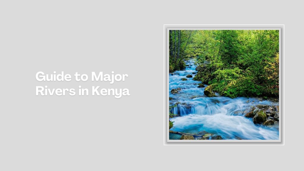
River Mathioya: Of Sparkling Serenity
Originating in the upper reaches of the Aberdare Range, making its way through the steep hills and valleys of Murang’a County, eventually joining the Tana River, Mathioya River is a significant river, if not the most important, in Murang’a County. Famous for its fast-flowing waters, the Mathioya River first flows through is self-same constituency of Mathioya, which takes great pride in the presence of the river. The folk never shy from pointing it out on sight to newcomers and visitors.
Generally speaking, Mathioya River is not very long, compared to some of Kenya’s mighty river, yet, its importance as a tributary to Kenya longest, Tana River, is vital. Some of the other important rivers in Central Kenya draining into the Tana include Thika, Ragati, Nyamindi, Thiba, and Chania River. Its good to point out that the mighty Tana River is, at the last, the main recipient of all the rivers in the region. Its flows for nearly 1,000 kilometres before debouching into the Indian Ocean.
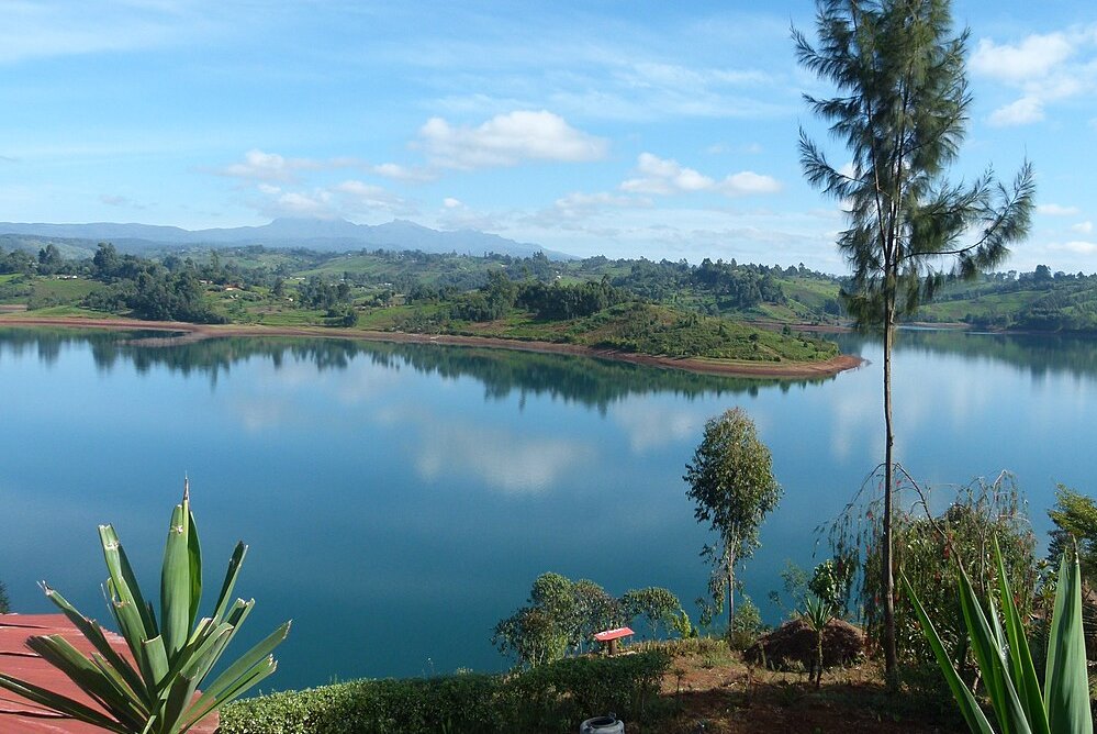
All along it 70 km stretch, before joining Sagana River, Mathioya River is broad-based in how the people utilize its sparkling resource. Closer to its headwaters, proximate to the Aberdare Range, Mathioya River is revered as a trout fishing haven, with plenty of fishing lodges and camps that have been in operation for many years now. It then flows through steep valleys and ridges in the western region of Murang’a County, creating a scenic landscape along its path. The river cuts through the rich agricultural lands, in a place known as a tea and coffee hub.
Soon after Mathioya and Maragua Rivers join the Sagana, renamed as Tana lower down, they are famous for whitewater rafting opportunities, especially during the rainy seasons when the river’s volume increases significantly. Its fast, turbulent waters and steep gradients make it a favorite destination for adventurous rafters. The Mathioya River offers breathtaking views, especially as it winds through the hilly terrain of Murang’a County. The deep gorges and forested banks provide a scenic backdrop, making it an attractive spot for photographers and nature lovers.
Kenya is blessed with several rivers, each playing a vital role in the country’s ecosystem, economy, and culture. The longest of these is the Tana, stretching approximately 1,000 kilometers from its source in the Aberdare Mountains to the Indian Ocean. Long, wide, short, seasonal, the rivers that crisscross Kenya each contributes to the natural beauty, biodiversity, and socio-economic success.
Index of The Longest Rivers in Kenya


River Tana - approx. 1,000 km: rising in Mount Kenya and Aberdare Ranges and draining into Indian Ocean; Ewaso Nyiro - approx. 700 km: rising in Mount Kenya and draining into the Lorian Swamp; Daua River - approx. 450 km; rising in the Sidamo Highland (through Ethiopia and Kenya) and draining into the Somali Sea; The Mara River - approx. 395 km, formed in Bomet County, after the Nyangores and Amala River merge, it drains into Lake Victoria, and is thus a tributary to the Nile River; Athi-Galana-Sabaki - approx. 390 km; rising in the Aberdare Ranges and draining into Indian Ocean; Mara River - approx. 380 km; rising in the Mau Escarpment and draining into Lake Victoria; Kerio River - approx. 350 km; rising in the Tugen Hills and draining into Lake Turkana; Turkwel River - approx. 340 km; rising in Mount Elgon and draining into Lake Turkana; River Nzoia - approx. 257 km: rising in the Cherangani Hills and draining into Lake Victoria; Southern Ewaso Nyiro - approx. 220 km; rising in the Mau Escarpment and drains into Lake Natron; River Yala - approx. 219 km; rising in the Nandi Escarpment and draining into Lake Victoria; Gucha River - approx. 190 kms: rising in the Kiabonyoru Hills in Nyamira County and draining into Lake Victoria; River Nyando - approx. 153 km: rising in the Mau Escarpment and draining into Lake Victoria


Murang’a County is a rich agricultural and cultural hub, known for its historical significance, beautiful landscapes, and important role in Kenya’s tea and coffee industries. The scenic hillscapes and cultural heritage makes Murang’a County a fascinating destination for visitors interested in nature, history, and agriculture.
You Are Here: Mathioya River
Where to Next?
Explore Destinations Nearby Mathioya River
A Guide to Muranga County


A Summa Digest of Muranga

About Muranga Way Back When

40 Destinations in Muranga County, arranged as one would visit these - south, north, west then east - with aid of narratives, images, strip maps and distance chart:

Gatura Greens Purple Tea Farm Tours, Kimakia Tea Cottage, Kimakia Falls, Kanunga Falls, Ndakaini Dam, Ndakaini Dam Marathon, Muchiri's Resort, Aberdare Forest, Elephant Hill, Aberdare Bongo Ecolodge, Ranges View Lodge, Manguyo Falls, Mathioya River, Kenya Fly Fishers (Southern Camp), Aberdare Cottages and Fishing Lodge, Mathioya River Lodge, Karuri Gakure Grave Site, Tuthu Catholic Church, Mukurwe Wa Gathanga, Karia Ka Mbari Ya Ngware, Wangu Wa Makeri Shrine, C70 Gacharage-Kangema Road, Maragua Dam, Maragua Falls, Old A2 Route, Muranga town, Kakuzi Boran Barn, Makuyu Golf Club, Makuyu Ridge, Eco Farmhouse, Muranga Gorges, Mathioya Dam, Muranga (St. James & All Martyrs) Church, Stanley’s Haven, Sagana Getaway Retreat, Tetura Sagana Camp, Laibon Gardens & Campsite, Jangwani Camp

Know More About Muranga County: Its Geography, Land-Use, Highlights, Population, Roads - including strip maps, Airports, Climate & National Monuments

What’s The Air Like In Muranga?
Maximum temperatures ranges between 26°C and 30°C, while the minimum ranges between 14°C and 18°C. In the western area, which is mostly high altitudes, the minimum temperatures can be as low as 6°C in July.


What’s The Lay Of The Land In C.21?
The topography and geology of Muranga is more or less sloping westerly towards the long Aberdare Range, the rain catchment from where most of rivers draining it originate. All these rivers flow south-eastward bound, to join Tana.
