
Waterfalls in Muranga


Kanunga Falls: A Healthful Walk
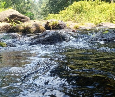
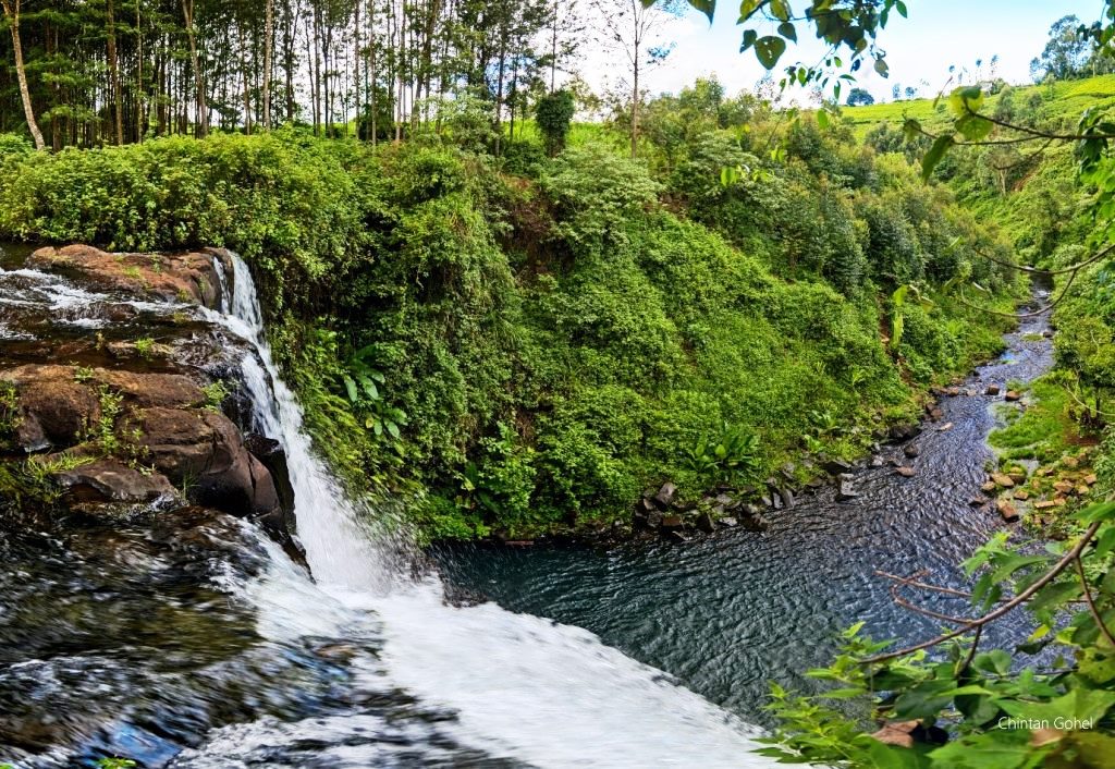
Most adventure-makers use Ndakaini Dam, 80 km north of Nairobi city, as the traditional jumping-off place to tour the easy-on-the-eye Kanunga Falls. After the rains, in May and November, Kanunga Falls is a large, powerful waterfall with a significant volume of water and a dramatic drop. The descending water maintains contact with the rock face behind it, plunging with a thunderous roar at the base.
Soon after the rains, rejuvenated, it spreads out, dramatically, like a horse’s tail, often with a slight fan shape. Although it dwindles significantly during the hotter months, with the water descending in narrowed cascade streams to the circular rock pool, it rarely fails to impress. Happy for the visitor, the surrounding glade, thanks to the cool temperate highland climate, are ever green and picturesque.
The journey to Kanunga Falls from Ndakaini Dam is more of a leisurely walk than it is a hike. It is a round-trip of about 8 km that takes on average 5 hours for anyone with average fitness. From Ndakaini Dam, you head out along the blacktop road for much of the distance excepting a few detours through farms and tree lined paths as you approach the falls. Its is pleasantly beautiful, and after you take in the sights you, can wade in the water, take a dip, or simply just catch your breath.

Touring waterfalls in Kenya offers a refreshing and adventurous experience, showcasing the country’s stunning natural beauty. Each waterfall – many still little known – provides a unique and memorable experience, whether you’re seeking adventure, relaxation, or simply the opportunity to connect with nature
Index of Waterfalls Around Kenya


Baringo County - Simot Falls, Kikojo Falls, Kapedo Falls, Bomet County - Tenwek Falls, Iria Maina Falls, Bungoma County - Teremi Falls, Malakisi Falls, Nabuyole Webuye Falls, Mwikhupo Falls, Elgeyo Marakwet County - Kessup Falls, Torok Falls, Embu County - Iveche Falls, Karurina Falls, Ndunda Falls, Nthenge Njeru Falls, Nthungu Falls, Paradiso Falls, Isiolo County - Gotu (Chanler's) Falls, Isiolo Falls, Kakamega County - The Isiukhu Falls, Sidikho Falls, Kericho County - Londiani Ruskebe Falls, The Chereres Falls, Kiptui Falls, Kiambu County - Ruaka Falls, Tigoni Hill Falls, Ruai Falls, Mashinani Falls, Karweti Falls, Kirinyaga County - Ruamuthambi Falls, Gatitika Falls, Thiba Falls, Kathiri Falls, The Castle Falls, Kang'ere Falls, Karumandi Falls, Kisii County - Nyamarambe Falls, Kwale County - Sheldrick Falls, Machakos County - Fourteen Falls, Makueni County - Kyanzizi Falls, Ilovoto Falls, Ka Kindui Falls, Meru County - Vivienne Falls, Nithi Gate Falls, Irine (Devil’s Bridge) Falls, Kathita Falls, Ngare-Ndare Falls, Muranga County - Kimakia Falls, Kanunga Falls, Maragua Falls, Manguyo Falls, Nakuru County - Cedar, Makalia Falls, Nandi County - Ngabunat Falls, Chepkiit Falls, Chemase Falls, Tindinyo Falls, Diguna Falls, Nyamira County - Nyamira Falls, Nyabomite Falls, Nyakwana Falls, Nyandarua County - Ragia Falls, Wanjohi Falls, Kenungu Falls, Ndaragwa Falls, The Thompson Falls, Nyeri County - Riakiania Falls, Kahuru Falls, Ragati Falls, Karuru Falls, Chania Falls, Gura Falls, Zaina Falls, Taita Taveta County - Kilangarenyi Falls, Dembwa Falls, The Lugard's Falls, Tana River County - Adamson's Falls, Tharaka Nithi County - Kibuuka Falls, Ikwa Falls, Hidden Falls, Ura Falls, Uasin Gishu County - Koromosho Falls, Kesses Falls, Two Rivers Falls, Kapsurur Falls, West Pokot County - Tartar Falls, Loumba Falls, Wish Yilat


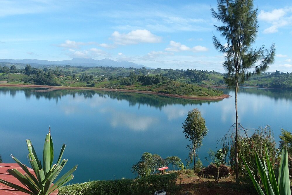
Murang’a County is a rich agricultural and cultural hub, known for its historical significance, beautiful landscapes, and important role in Kenya’s tea and coffee industries. The scenic hillscapes and cultural heritage makes Murang’a County a fascinating destination for visitors interested in nature, history, and agriculture.
You Are Here: Kanunga Falls
Where to Next?
Explore Destinations Nearby Kanunga Falls
A Guide to Muranga County


A Summa Digest of Muranga

About Muranga Way Back When

40 Destinations in Muranga County, arranged as one would visit these - south, north, west then east - with aid of narratives, images, strip maps and distance chart:

Gatura Greens Purple Tea Farm Tours, Kimakia Tea Cottage, Kimakia Falls, Kanunga Falls, Ndakaini Dam, Ndakaini Dam Marathon, Muchiri's Resort, Aberdare Forest, Elephant Hill, Aberdare Bongo Ecolodge, Ranges View Lodge, Manguyo Falls, Mathioya River, Kenya Fly Fishers (Southern Camp), Aberdare Cottages and Fishing Lodge, Mathioya River Lodge, Karuri Gakure Grave Site, Tuthu Catholic Church, Mukurwe Wa Gathanga, Karia Ka Mbari Ya Ngware, Wangu Wa Makeri Shrine, C70 Gacharage-Kangema Road, Maragua Dam, Maragua Falls, Old A2 Route, Muranga town, Kakuzi Boran Barn, Makuyu Golf Club, Makuyu Ridge, Eco Farmhouse, Muranga Gorges, Mathioya Dam, Muranga (St. James & All Martyrs) Church, Stanley’s Haven, Sagana Getaway Retreat, Tetura Sagana Camp, Laibon Gardens & Campsite, Jangwani Camp

Know More About Muranga County: Its Geography, Land-Use, Highlights, Population, Roads - including strip maps, Airports, Climate & National Monuments

What’s The Air Like In Muranga?
Maximum temperatures ranges between 26°C and 30°C, while the minimum ranges between 14°C and 18°C. In the western area, which is mostly high altitudes, the minimum temperatures can be as low as 6°C in July.


What’s The Lay Of The Land In C.21?
The topography and geology of Muranga is more or less sloping westerly towards the long Aberdare Range, the rain catchment from where most of rivers draining it originate. All these rivers flow south-eastward bound, to join Tana.
