
The Diverse Highlands


A Summa Digest of Muranga County
140 km directly north of Nairobi lies Nyeri town, the former provincial capital of Central Province, or the Central Highlands of Kenya, a constellation of fairly small counties that share the invaluable advantage of proximity to either Mount Kenya or Aberdare Ranges. The Central Highlands comprises of the five whose borders converge at the very top of Mount Kenya, and Muranga, Kiambu and Nyandarua counties along the slopes of the Aberdare Ranges. Muranga County is, of course, historically germane, for this is where the much-talked but rarely visited hamlet of origin for the Kikuyu community is sited – the famed Mukurwe wa Nyagathanga.
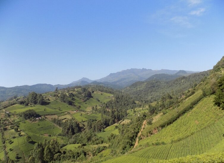
Kikuyuland, or the area bound by the four mountains of Mount Kenya, Ngong Hills, the Aberdare Ranges and Ol Donyo Sabuk Hill is, as one would expect, hilly. With much of Muranga County flanking a long stretch of the Aberdare Ranges, nearly 70% of its surface area is considered hilly. So much so, that the only noted natural landmarks seen are its hills. The terrain in Muranga County rises gradually from an altitude of 914 ms in the east to 3,353 ms along the slopes of the Aberdare Range, where the precipitous and acclivitous landscape, composed of scarped valleys punctuated by bulbous hills, very often associated with Muranga, is at full stride.
The principal line of communication in Central Kenya is the A2 Nairobi-Nanyuki-Meru-Moyale Road. From the main business district of Nairobi, you drive out along the peri-urban dormitory area of Kiambu County for 50 km to Thika town, which is the border with Muranga County. Outwith, the urban landscape begins to disappear and farmlands start their domination, a prevailing feature of Central Kenya. The next 17 km to Kenol town are noted for the large scale farms at Del Monte and Kakuzi. At Kenol, you leave the A2 Road onto the C71 Kenol-Muranga Road, the secondary principal line; distance from Kenol to Muranga town 48 km.
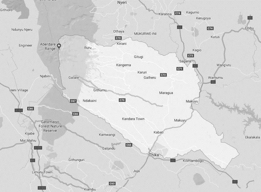
Along the A2 Road, Muranga County extends for 47 km to Sagana town, on both sides of the road to Makuyu town, and to the left of the A2 from Makuyu bordering a small part of Machakos County, Embu County up to Makutano, then Kirinyaga County to Sagana town. The secondary road, C71, will get you to Sagana town in 50 km. Muranga is bound in the south by Kiambu, in the north by Nyeri, in the west by Nyandarua, and in the east by Kirinyaga, Embu and Machakos counties.
Heading west into Muranga County, away from the A2 and C71 Roads that travel almost parallel, the terrain become continually hilly until the Aberdare Ranges are reached, marking the western marches. The highest regions, in the west, have a deeply dissected topography, drained by several goodly rivers like Mathioya and Maragwa, which both flow eastward to join with Tana River – the main recipient of all the rivers in Central Kenya. The lands are fertile and well watered. For the motorist, this should obviously suggest that the roads are steep and winding.
By the same token, the bulk of the valleys in Muranga County, some as deep as 100 ms, have sparkling streams and rivers flowing through them, most rising from the Aberdare Forest. All these offer both serenity and spectacular beauty. Granted that fishing has always been a major draw for Muranga County, steadily increasing in demand in recent years, fishing in these scenic streams and rivers has gained national interest, with an growing number of visitors now running into hundreds each year visiting the county primarily for a weekend of fishing the prized trout.
This has been followed by the rise of several idyllic fishing lodges, especially along the Aberdare Range, where organizational and guide support, to find great fishing spots for a fine day of fishing in the alpines, is amazingly pocket-friendly. It’s not at all rare to catch a dozen brown or rainbow trout weighing over 10 pounds in the delightful rivers in pleasant surroundings of forested glade and sparkling streams.
Muranga County takes pride as the home to a number of historically significant destinations. It features, as alluded to above, the distinguished Mukurwe wa Nyagathanga, Karia ka Mbari ya Ngware and Muranga (St. James & All Martyrs) Church. Also within its bucolic setting, enjoying year-round temperate weather and lush greenery, is a historic edifice built by the Catholic Mission in partnership with the local community, dating back to 1902, marketed as one of the historically significant Churches in Kenya. At an adjacent site is a century old native shrine.
Salient Features of Muranga County
- County Number 21
- Area – 2558 km2
- Altitude – 2998-11000 ft
- Major Towns – Muranga, Kenol, Kiriani
- Borders – Nyeri, Kiambu, Nyandarua, Embu, Kirinyaga, Machakos

Murang’a County is a rich agricultural and cultural hub, known for its historical significance, beautiful landscapes, and important role in Kenya’s tea and coffee industries. The scenic hillscapes and cultural heritage makes Murang’a County a fascinating destination for visitors interested in nature, history, and agriculture.
You Are Here: Muranga County
Where to Next?
Explore Destinations in Muranga County
A Guide to Muranga County
A Summa Digest of Muranga
About Muranga Way Back When
40 Destinations in Muranga County, arranged as one would visit these - south, north, west then east - with aid of narratives, images, strip maps and distance chart:
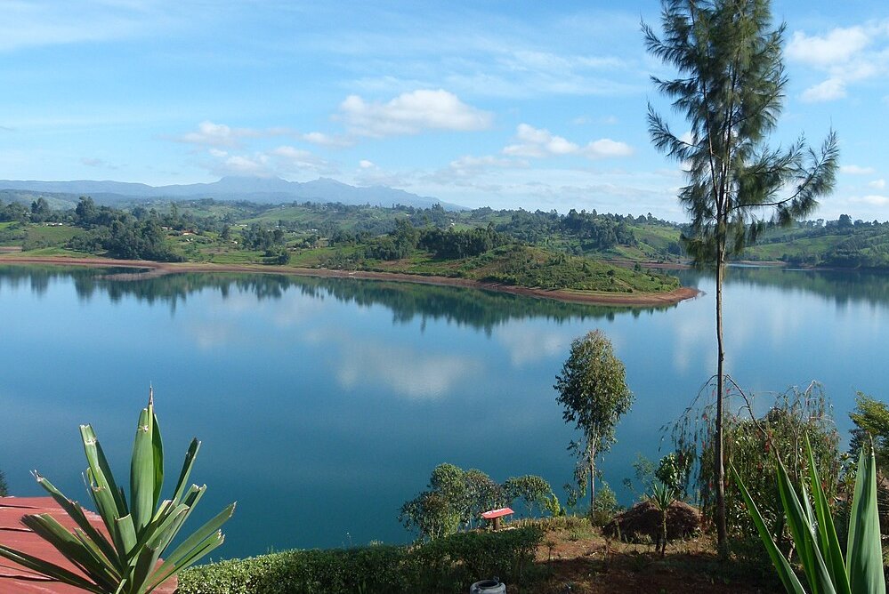
Gatura Greens Purple Tea Farm Tours, Kimakia Tea Cottage, Kimakia Falls, Kanunga Falls, Ndakaini Dam, Ndakaini Dam Marathon, Muchiri's Resort, Aberdare Forest, Elephant Hill, Aberdare Bongo Ecolodge, Ranges View Lodge, Manguyo Falls, Mathioya River, Kenya Fly Fishers (Southern Camp), Aberdare Cottages and Fishing Lodge, Mathioya River Lodge, Karuri Gakure Grave Site, Tuthu Catholic Church, Mukurwe Wa Gathanga, Karia Ka Mbari Ya Ngware, Wangu Wa Makeri Shrine, C70 Gacharage-Kangema Road, Maragua Dam, Maragua Falls, Old A2 Route, Muranga town, Kakuzi Boran Barn, Makuyu Golf Club, Makuyu Ridge, Eco Farmhouse, Muranga Gorges, Mathioya Dam, Muranga (St. James & All Martyrs) Church, Stanley’s Haven, Sagana Getaway Retreat, Tetura Sagana Camp, Laibon Gardens & Campsite, Jangwani Camp
Know More About Muranga County: Its Geography, Land-Use, Highlights, Population, Roads - including strip maps, Airports, Climate & National Monuments

What’s The Air Like In Muranga?
Maximum temperatures ranges between 26°C and 30°C, while the minimum ranges between 14°C and 18°C. In the western area, which is mostly high altitudes, the minimum temperatures can be as low as 6°C in July.


What’s The Lay Of The Land In C.21?
The topography and geology of Muranga is more or less sloping westerly towards the long Aberdare Range, the rain catchment from where most of rivers draining it originate. All these rivers flow south-eastward bound, to join Tana.
