
The Goldish Farmlands


A Summa Digest of Migori County
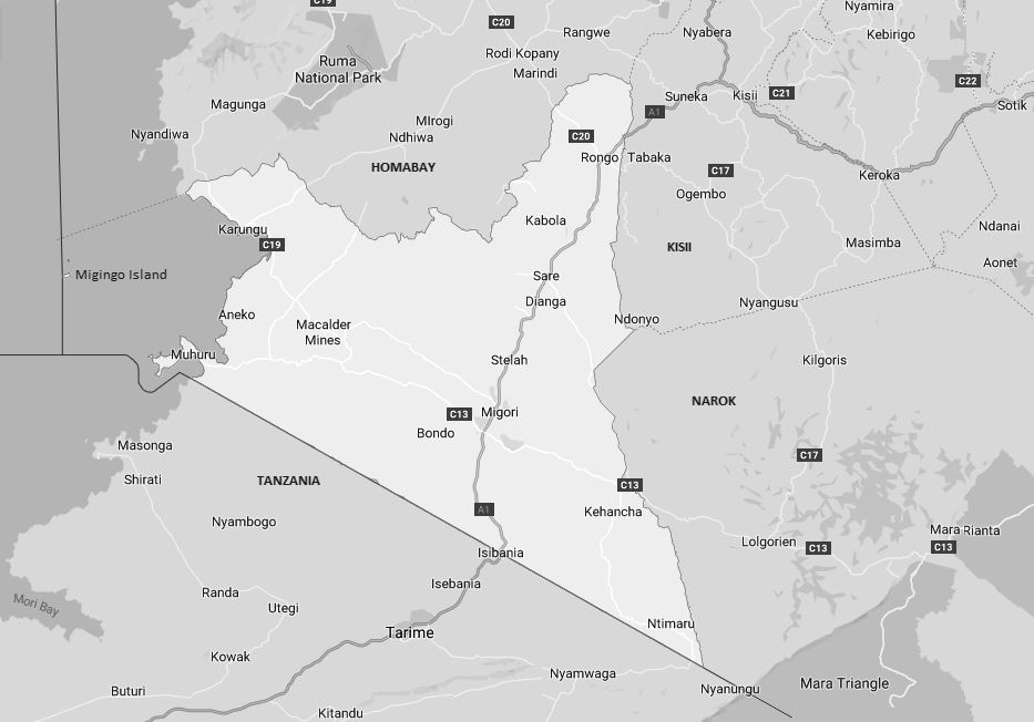
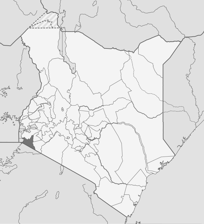
Like Embu County in Central Kenya, Migori County resembles a scalene triangle drawn with an unsteady hand with its apex thrust into Homa Bay County. Located in the southwestern region of Kenya, its furthest reaches border Tanzania to the south and Lake Victoria to the west. It borders Kisii County to the northeast, and Narok County to the east. The principal line of communication in Migori County is the A1 international trunk road that traverses it just west of south from Rongo to Isebania, travelling near parallel with its eastern border. All secondary roads stem from the all important A1 Road. The economy of Migori County is largely agrarian.
Migori County is at the heart of the tropics, bordered by the Lake Victoria to the west, yet, the climate over most of the area, thanks to the altitude, is pleasant. With a massive improvement to the roads, travel to Migori has all changed and access to its destinations is easier and trippers can now easily combine options. Well-known for the Migori Gold Belt, Migori owes its geological importance to a narrow zone of gold which runs east-south-east in the valley of Migori River in the eastern quarter of the county and just 16 km north of the Kenya-Tanzania border.
Migori County is widely-known for its rich minerals, particularly gold. Artisanal gold mining has been a significant source of income for local communities, with several small-scale mining operations in the area. The gold-belt, more popular as the Macalder Mines, is documented to have been discovered here as early as 1904, but was not in ‘workable quantities’. Visitors interested in learning about the local mining economy can visit the artisanal gold mines in the region, though it’s important to arrange visits through local guides. Despite its natural resources and gainful agricultural potential, parts of Migori County face high levels of poverty.
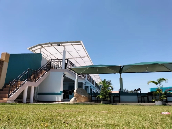
Most travellers take in a tour of Migori County, either on their way to Tanzania through Isebania or on their way back from the Masai Mara National Reserve through Kilgoris town. On the map, Migori is relatively small, wedged between Narok, Kisii and Homa Bay counties with its western boundary straddling Lake Victoria. It’s reached via A1 Nairobi-Isebania Road through Ahero, Oyugis and Suneka before arriving at Rongo. End to end it is only 63 km, from Rongo in the north to Isebania in the south and the border-point to Tanzania. The drive across Migori takes the motorist through some of the prettiest sugar farms in Kenya.
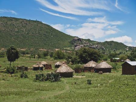
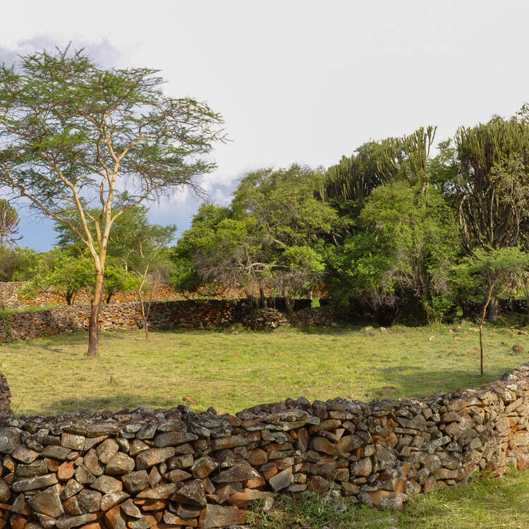
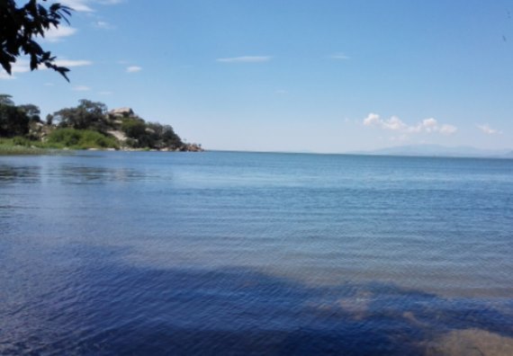
Holiday-makers from the Masai Mara National Reserve with a day to spare can swing over to Migori via Kilgoris and enjoy the longer more scenic route back to Nairobi through sites like the Thimlich Ohinga, a UNESCO World Heritage Site, Gogo Falls and Macalder Mines. Along the shores of Lake Victoria, travellers can enjoy great sights and sunsets at Muhuru Bay. For the more adventurous at heart, Migingo Island provides a unique opportunity to explore the life and culture of this small fishing Island settlement. From Migori County, the A1 Road offers many picturesque views as it meanders through a reposeful and rural backcountry.
Salient Features of Migori County
- County Number 44
- Area – 2586 km2
- Altitude – 4921 ft
- Major Towns – Rongo, Awendo, Migori
- Borders – Narok, Kisii, Homa Bay

Migori is a diverse and culturally rich county with vast agricultural potential, significant mineral resources, and proximity to important cross-border trade routes. While it faces challenges, Migori County offers great opportunities for touring, especially with attractions like Thimlich Ohinga and Lake Victoria.
You Are Here
Where to Next?
Explore Destinations in Migori County
A Guide to Migori County


A Summa Digest of Migori

About Migori Way Back When

22 Destinations in Migori County, arranged as one would visit these - east, north, south then west - with aid of in-depth narratives, images, maps and distance chart:

Rongo Town, Treat House Resort, Gogo Falls, Gogo Falls Prehistoric Site, Awendo Town, Got Kwer Shrine, Mugabo Caves, Muhuru Bay, Lobby Resort, Migingo Island, Lake Victoria Sanctuary, Macalder Mines, Kuja River, Kuja Irrigation Scheme, Thimlich Ohinga Landscape, Chinato Crying Stone, Nyaandui Forest, Komotobo Mission Church, Kebharisia Dam, Nyamiencho Coffee Farm, Trans Mara Forest Conservation Area

Know More About Migori County: Its Geography, Land-Use, Highlights, Population, Roads - including a distance chart, Airports, Climate & National Monuments

What’s The Air Like In Migori?
Temperatures in Migori range between 24oC and 31oC. The driest months are December to February. Long rains occur between March and May.

What’s The Lay Of The Land In C.44?
The altitude in Migori ranges between 1140 ms about Lake Victoria in Nyatike to 4625 ms in Uriri.Undulating hills covers much of the county with few stretches of arable flat land.
