
Major Rivers in Mandera


River Daua or Dawa: A Slice of Heaven
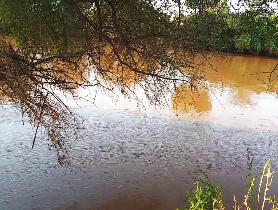
Mandera County’s drainage is, to a large extent, dispensed by the tremendous River Daua, sometimes spelt Dawa. Almost every other stream is intermittent, flowing seasonally, with exception of the Daua River, whose headwaters are in Ethiopia. The Daua River rises on the Ethiopian Highlands, flowing southeastward, and forming part of the border between Kenya and Ethiopia, before it eventually merges into the Jubba River, which continues into Somalia as the Webiga Daawa.
Needless to point out is that Mandera County, owing to its low altitude, is a water deficient outback and life here is an endless search for water at laghas or riverbed in which water runs occasionally and shallow groundwater in the wadi beds. It is no surprise then, that the Daua River holds cultural significance for the indigenous Somali communities in the region. Traditional practices, beliefs, and livelihoods are closely tied to the river, making it an integral resource of their cultural heritage.
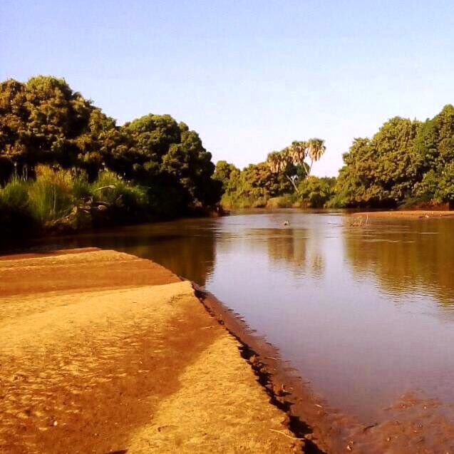
A vital lifeline, River Daua flows for 160 km in the north and northeast area of Mandera County, along Mandera Plateau or Daua Valley. From its headwaters to its mouth, it replenishes a vast river catchment of about 58,961km2. All along its course, the Daua River supports a riparian ecosystem that’s contrary verdant compared to the surrounding arid and semi-arid landscapes. In stack contrast, along the riverine, rises a dense vegetal profile with a mix of woodland, doum palms, shrubs, and grasses that provide habitat for various species of wildlife.
Rather more importantly, River Daua is the main source of water for the people and livestock of Libehia, Malka Mari, Rhamu, Dimti and Khalalio townships. The riverine areas of Rhamu, Kalicha, Girissa, Rhamu, Dimti and Shantolei also use the water from River Daua for irrigation to grow varied crops like cowpeas, onion, pawpaw, citrus and melons. Managing the water resources of the Daua River is crucial, especially given the arid climate and the reliance by local communities.
Effective water management practices are needed to ensure sustainable use and to mitigate conflicts over water access. Given that the Daua River forms part of the border between Kenya and Ethiopia, cross-border cooperation is essential for the management and conservation of the river. Collaborative efforts between the two countries can help address shared challenges and promote sustainable development in the region, to ensure that it continues to meet the myriad needs.
Kenya is blessed with several rivers, each playing a vital role in the country’s ecosystem, economy, and culture. The longest of these is the Tana, stretching approximately 1,000 kilometers from its source in the Aberdare Mountains to the Indian Ocean. Long, wide, short, seasonal, the rivers that crisscross Kenya each contributes to the natural beauty, biodiversity, and socio-economic success.
Index of The Longest Rivers in Kenya


River Tana - approx. 1,000 km: rising in Mount Kenya and Aberdare Ranges and draining into Indian Ocean; Ewaso Nyiro - approx. 700 km: rising in Mount Kenya and draining into the Lorian Swamp; Daua River - approx. 450 km; rising in the Sidamo Highland (through Ethiopia and Kenya) and draining into the Somali Sea; The Mara River - approx. 395 km, formed in Bomet County, after the Nyangores and Amala River merge, it drains into Lake Victoria, and is thus a tributary to the Nile River; Athi-Galana-Sabaki - approx. 390 km; rising in the Aberdare Ranges and draining into Indian Ocean; Mara River - approx. 380 km; rising in the Mau Escarpment and draining into Lake Victoria; Kerio River - approx. 350 km; rising in the Tugen Hills and draining into Lake Turkana; Turkwel River - approx. 340 km; rising in Mount Elgon and draining into Lake Turkana; River Nzoia - approx. 257 km: rising in the Cherangani Hills and draining into Lake Victoria; Southern Ewaso Nyiro - approx. 220 km; rising in the Mau Escarpment and drains into Lake Natron; River Yala - approx. 219 km; rising in the Nandi Escarpment and draining into Lake Victoria; Gucha River - approx. 190 kms: rising in the Kiabonyoru Hills in Nyamira County and draining into Lake Victoria; River Nyando - approx. 153 km: rising in the Mau Escarpment and draining into Lake Victoria

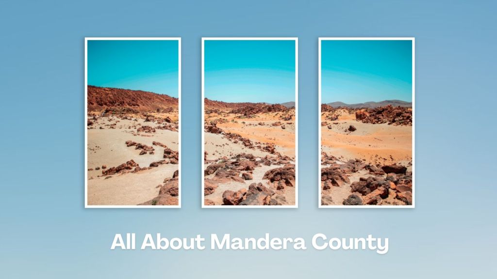
Mandera County, in northeastern Kenya, sharing borders with Ethiopia to the north and Somalia to the east, is a place of unique geographical features, cultural diversity, and unique socio-economic activities. Its obscurity stems from the facts that it is a semi-arid block, with rampant insecurity, and limited infrastructure development. Even so, Mandera County harbours many little-known surprises!
You Are Here: Daua (Dawa) River
Where to Next?
Explore Destinations Nearby Daua (Dawa) River
A Guide to Mandera County


A Summa Digest of Mandera

About Mandera Way Back When

8 Destinations in Mandera County, arranged as one would visit these - south, north then west - with the aid of in-depth narratives, images, strip maps and distance chart:

El Wak Ancient Wells, Fort El Wak, Marehan Sandstone, Malka Mari National Park, River Daua, Dandu Hills, Red Sea Resort, Mandera Town

Know More About Mandera County: Its Geography, Land-Use, Highlights, Population, Roads - including strip maps, Airports, Climate & National Monuments


What’s The Lay Of The Land In C.09?
For the most parts plain, only exemplified by its low-lying notable rocky hills which rise gradually from 400 ms south at Elwak to 970 ms asl along the boundary with Ethiopia.

What’s The Air Like In Mandera?
Temperatures are always high in Mandera, with a minimum of 24oCelsius in July and a maximum of 42oCelsius in February. Rainfall is scanty, unreliable and unpredictable.

