
The Obscure Outlier


A Summa Digest of Mandera County
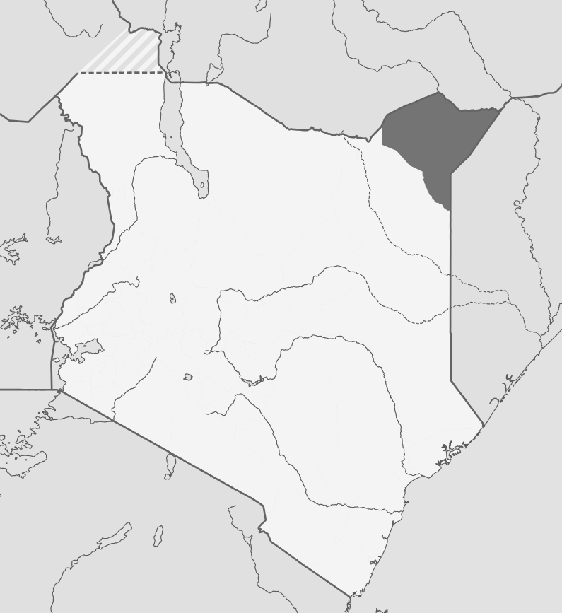
Mandera County occupies the extreme northeastern triangular corner of Kenya, sharing borders with Ethiopia to the north and Somalia to the east. In the north, Daua River contrives the natural boundary with Ethiopia. It borders the expansive Wajir County in the west and south. With the altitude rarely rising over 2,000 ft., Mandera County is, end to end, semi arid. Except for several hill ranges and the peneplain dissected in the north by Daua River, it is a torrid desolate country. During the hot season, January to March, noon shade temperatures above 45 C. have been reported, and the the mean annual temperature is a little below that.
That’s to also say, Mandera County is a sweltering summer outback year-round. The land surface is concomitantly typified by a bright limestone, shale and sand. The sandy soil is covered, often scantily, by an open thorn shrub with large trees along some of the dryer riverbeds, with far between switchbacks to thorn bush and patches of trees. The bushland vegetation is sometimes unpleasantly dense along gullies and glades in the southern region, and often around ‘laghas’ where water accumulates during the rainy season. In the dry season, the monotony of dry ‘bushland’ is only relived by the fringe of the doum palms along River Daua.
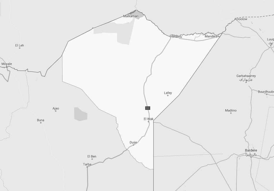
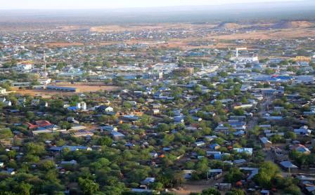
Mandera town, its capital, lying at the very northeast tip, is reached from Garissa through El Wak by a road that follows the international boundary to Bur Mansa, where it leaves the border and skirts the Hegalu Hills. A road from Mandera town westerly heading to Malka Muri National Park runs along Daua valley, near parallel with the Ethiopian border through Rhamu, where a road branches off to the south.
The 1,135 km dreaded odyssey from Nairobi to Mandera town is, at best, a death-or-glory gutsy journey for the strong-minded intrepid. An undertaking of will and brute strength. From Garissa town, where the smooth road ends abruptly, begins the 735 km Mari-Run that cuts through the desolate and unrelenting plains, only punctuated by few and far between hills. It is necessary to fill up with petrol at Garissa town and carry reserves. Outwith, filling stations are almost mythical.
The dusty road northerly heading through the unforgiving plains is layered with limestone outcrops, which render it difficult to drive over even with a good 4X4 vehicle. So if the object of the journey is to get to Mandera town, it should take you the better part of 24 hours. During the rainy season, the B7 Wajir-Mandera road is almost impassible. During the rains, vehicular traffic through the area is discouraged in order to conserve and protect the surfaces of the road to boot.
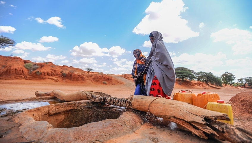
The jerry-built centres along the Mari-Run rarely have adequate supplies or provide any reasonable accommodation. In spite of its impertinent security, inhospitable weather, tough drive and unsparing dust-clouds, Mandera County is a rarely seen landscape with sweeping vistas over the mountains and wide-bay peaks that off-again fill the scene. It is also a focal point for the Somali culture.
Limited infrastructure development, particularly in transportation, healthcare, and education, poses challenges to Mandera County’s unrealized socio-economic progress. Currently, its trunk roads have been cut through the bush and are little better than motorable tracks, which become impassable during the rain season. Investments in infrastructure are crucial for the county’s development. Mandera County, with its unique landscape, cultural heritage and economic potential, is working towards overcoming its challenges and improving the quality of life for its resilient residents through various development initiatives and community efforts.
Salient Features of Mandera County
- County Number 09
- Area – 25991 km2
- Altitude – 2000 ft
- Major Towns – Mandera, Tabaka, Banissa
- Borders – Wajir, Somalia, Ethiopia
Mandera County, in northeastern Kenya, sharing borders with Ethiopia to the north and Somalia to the east, is a place of unique geographical features, cultural diversity, and unique socio-economic activities. Its obscurity stems from the facts that it is a semi-arid block, with rampant insecurity, and limited infrastructure development. Even so, Mandera County harbours many little-known surprises!
You Are Here: Mandera County
Where to Next?
Explore Destinations in Mandera County
A Guide to Mandera County


A Summa Digest of Mandera

About Mandera Way Back When

8 Destinations in Mandera County, arranged as one would visit these - south, north then west - with the aid of in-depth narratives, images, strip maps and distance chart:

El Wak Ancient Wells, Fort El Wak, Marehan Sandstone, Malka Mari National Park, River Daua, Dandu Hills, Red Sea Resort, Mandera Town

Know More About Mandera County: Its Geography, Land-Use, Highlights, Population, Roads - including strip maps, Airports, Climate & National Monuments


What’s The Lay Of The Land In C.09?
For the most parts plain, only exemplified by its low-lying notable rocky hills which rise gradually from 400 ms south at Elwak to 970 ms asl along the boundary with Ethiopia.

What’s The Air Like In Mandera?
Temperatures are always high in Mandera, with a minimum of 24oCelsius in July and a maximum of 42oCelsius in February. Rainfall is scanty, unreliable and unpredictable.

