
Kenya’s Rice Basket


A Summa Digest of Kirinyaga County
Physiographically Kirinyaga County, and the four others whose borders extend to the summit, is dominated by the towering bulk of the dome-shaped Mount Kenya volcanic pile, occupying the northern quarter of county. Below the open moorland at 10,000 feet, roughly demarcating the reach of Mount Kenya National Park, the lower slopes are incised to depths of up to 600 feet by a system of radial streams. Lower down, these merge to form Nyamindi, Thiba, Rupingazi, Rwamuthambi and Ragati Rivers. Kirinyaga’s other salient river, Sagana, rises in the Aberdare Ranges. These rivers, with about two dozen amazing waterfalls, drain into the Tana River.
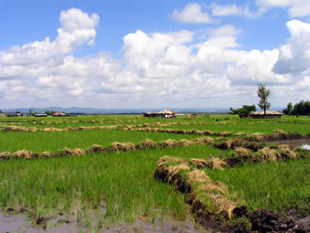
Kirinyaga County is traditionally associated as the rice basket of Kenya, and as a gateway to Mount Kenya National Park. Most of its rice fields unfold behind the beautiful mountain and enjoy wonderful landscapes. The rice fields have been a photographer’s delight for ages. In more recent times, the addition of adventure sports along Sagana River has become a budding epicenter of Kirinyaga County, where adventure-makers come from far and wide to take in its dares, specially of the water rafting exploits which thrill and throw you in a panic at the same time.
The road system in Kirinyaga County, on the flanks of Mt. Kenya, is influenced by the number of rivers and streams draining radially from the mountain. Most roads follow the ridges, interconnecting rural roads to the secondary and primary roads. The principal line of communication in Kirinyaga County is the long B6 Makutano-Mururi-Embu-Meru Road, which leaves the A2 Nairobi-Moyale Road and crosses it along the southern region. Two secondary roads, C74, branch off northwesterly to rejoin the A2 at Kibirigwi and Karatina. Beyond Embu town, the B6 Road makes a wide loop through Embu and Meru counties and rejoins the A2 near Isiolo town.
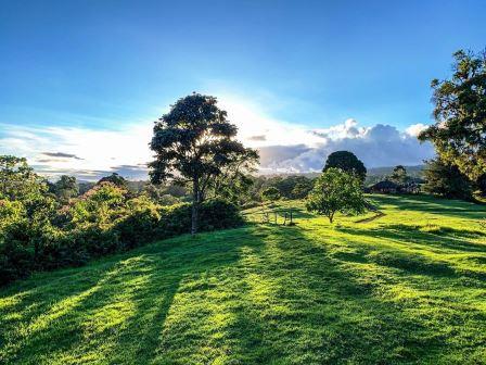
By and large, Kirinyaga County is an agrarian county, which also grows some of the top-tier coffee in Kenya. Emblematic of Central Kenya, it is an impressively verdant country and much of its beauty arises from the endless patches of green fields abounding with produce, its indigenous forests, its wooded hillocks and steep valleys, which are crossed by big rivers. Within its overall slope are many stream and rivers which all, lower down, converge into the mighty River Tana, which will eventually drains into Indian Ocean after traversing almost 600 kms.
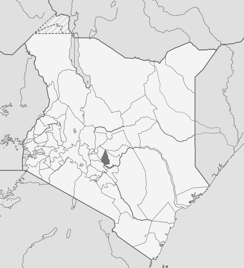
Although Kirinyaga County is only half the size of the adjoining Embu County, the two have many similarities. On the map, both resemble scalene triangles drawn with an unsteady hand with their apex thrust into Mount Kenya; and the imaginary triangles incline moderately from apex to base. Kirinyaga County can be split into three ecological zones; highland, midland and lowland. The lowland, about Mwea, is marked by rolling plains, where rice is farmed. Kirinyaga is bordered by Embu County to the east, Nyeri County to the west, and Murang’a County to the south.
Salient Features of Kirinyaga County
- County Number 20
- Area – 1478 km2
- Altitude – 1151 to 5199 ms
- Major Towns – Kerugoya, Sagana, Kianyaga
- Borders – Embu, Muranga, Nyeri
Known for its agricultural productivity, breathtaking landscapes, and cultural heritage, Kirinyaga is a key contributor to Kenya’s economy. Located at the foot of Mount Kenya, its landscape is characterized by lush green tea and coffee farms, rivers, and rolling hills, and the weather, year-round, is temperate and salubrious.
You Are Here: Kirinyaga County
Where to Next?
Explore Destinations in Kirinyaga County
A Guide to Kirinyaga County


A Summa Digest of Kirinyaga

About Kirinyaga Way Back When

35 Destinations in Kirinyaga County, arranged as one would visit these - south, west, east then south - with the aid of narratives, images, strip maps and distance chart:

Sagana Getaway Resort, Camp Malta, Tana Station, Thingira Cultural Village, Kwetu Home, Gatitika Falls, River Nyamindi, Mwea Rice Scheme, Mwea Classic Marathon, Ndaraca ya Ngai, Rukenya Islands, Murinduko Hill, Njukiini Forest, Kijani Camp, Timstep Hotel & Campsite, Savage Wilderness, Rapids Camp, Sagana Fisheries, Ruamuthambi Falls, Thiba Falls, Thiba Dam, Kamuruana Hill, Ragati Conservancy, Kiburi Farm & Stay, Thiba Fishing Camp, Outdoorsman Cabins, Kathiri Falls, Castle Forest Lodge, Castle Falls, Mount Kenya, Kamweti Route, Kangere Falls, Gichugu Farms, Karumandi Falls

Know More About Kirinyaga County: Its Geography, Land-Use, Highlights, Population, Roads - with aid of strip maps, Airports, Climate & National Monuments

What’s The Air Like In Kirinyaga?
Kirinyaga has a true tropical climate with equatorial rainfall pattern. Mean temperature ranges from a low of 8oC in the upper zones to 30oC in the lower zones about Mwea.


What’s The Lay Of The Land In C.20?
Mount Kenya, occupying on the northern half of Kirinyaga, to a large extent influences both the landscape and the climate. The dryer lowland, typified by pleasant rolling plains, covers most of Mwea.
