
Waterfalls in Isiolo County


Gotu (Chanler’s) Falls: A Stunning Sheet Falls
There are two routes to approach Gotu Falls, formerly known as Chanler’s Falls, named after the explorer, W.A. Chanler: West to east via the Isiolo-Garba Tula Road then northward from Garba Tula through Kurru Barata to the road linking Gotu Falls and Archers Post; or vice-versa if approaching from Archer’s Post. North of Ewaso Nyiro the area is crossed by a road linking Archer’s Post to Merti.
Previously, before the completion of new Gotu Bridge in 2019, the latter, longer route starting at Archer’s Post was more popular, despite its perceived and real insecurities, because it avoided a dicey series of deep gullies near Tumtu and incidences of herders and motorists being swept off the unrailed makeshift old Gotu Bridge, oft-times covered by the overflowing river during the rain season.
It is the new Gotu Bridge that offers wayfarers the safest vantage to view Gotu Falls. South-east of Tumtu Hill the river pours over a ledge of basalt, the water dropping 60 or so feet and almost 50 metres wide in single stunning cascade, thereafter flowing for 3 km betwixt sheets of black lava. It was renamed during Ludwig von Höhnel’s second expedition in East Africa, this time accompanying William Astor Chanler, a wealthy American who wished to explore Lake Rudolf.
On September 18th, 1892, the two set out from the coast along a more northerly passage than that previously traversed with Count Samuel Teleki from 1887. On December 26, 1892, they came upon a waterfall some sixty feet in height on the Ewaso Nyiro River, and named it Chanler’s Falls. The did not however see their treasured waterfalls at its greatest. Generally speaking, Ewaso Nyiro River flows with low water for much of the year, lowest in March and highest around May.
Soon after the rains, the transient Gotu Falls broadens tremendously, creating a smooth, sheet cascade, among the largest of its kind in Kenya. Fairly untravelled, it is at this time impressive, when the water flow is strong, the cascade spread out evenly over more than 50 metres in width, as it descends, appearing as a massive sheet of water, especially stunning when viewed from the front. Gotu Falls flows over relatively smooth, flat rock surfaces, allowing the water to spread out evenly.

Touring waterfalls in Kenya offers a refreshing and adventurous experience, showcasing the country’s stunning natural beauty. Each waterfall – many still little known – provides a unique and memorable experience, whether you’re seeking adventure, relaxation, or simply the opportunity to connect with nature
Index of Waterfalls Around Kenya


Baringo County - Simot Falls, Kikojo Falls, Kapedo Falls, Bomet County - Tenwek Falls, Iria Maina Falls, Bungoma County - Teremi Falls, Malakisi Falls, Nabuyole Webuye Falls, Mwikhupo Falls, Elgeyo Marakwet County - Kessup Falls, Torok Falls, Embu County - Iveche Falls, Karurina Falls, Ndunda Falls, Nthenge Njeru Falls, Nthungu Falls, Paradiso Falls, Isiolo County - Gotu (Chanler's) Falls, Isiolo Falls, Kakamega County - The Isiukhu Falls, Sidikho Falls, Kericho County - Londiani Ruskebe Falls, The Chereres Falls, Kiptui Falls, Kiambu County - Ruaka Falls, Tigoni Hill Falls, Ruai Falls, Mashinani Falls, Karweti Falls, Kirinyaga County - Ruamuthambi Falls, Gatitika Falls, Thiba Falls, Kathiri Falls, The Castle Falls, Kang'ere Falls, Karumandi Falls, Kisii County - Nyamarambe Falls, Kwale County - Sheldrick Falls, Machakos County - Fourteen Falls, Makueni County - Kyanzizi Falls, Ilovoto Falls, Ka Kindui Falls, Meru County - Vivienne Falls, Nithi Gate Falls, Irine (Devil’s Bridge) Falls, Kathita Falls, Ngare-Ndare Falls, Muranga County - Kimakia Falls, Kanunga Falls, Maragua Falls, Manguyo Falls, Nakuru County - Cedar, Makalia Falls, Nandi County - Ngabunat Falls, Chepkiit Falls, Chemase Falls, Tindinyo Falls, Diguna Falls, Nyamira County - Nyamira Falls, Nyabomite Falls, Nyakwana Falls, Nyandarua County - Ragia Falls, Wanjohi Falls, Kenungu Falls, Ndaragwa Falls, The Thompson Falls, Nyeri County - Riakiania Falls, Kahuru Falls, Ragati Falls, Karuru Falls, Chania Falls, Gura Falls, Zaina Falls, Taita Taveta County - Kilangarenyi Falls, Dembwa Falls, The Lugard's Falls, Tana River County - Adamson's Falls, Tharaka Nithi County - Kibuuka Falls, Ikwa Falls, Hidden Falls, Ura Falls, Uasin Gishu County - Koromosho Falls, Kesses Falls, Two Rivers Falls, Kapsurur Falls, West Pokot County - Tartar Falls, Loumba Falls, Wish Yilat

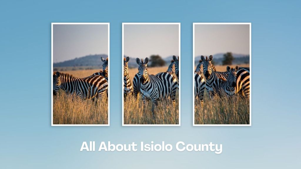
Isiolo County, with its strategic location, rich cultural heritage, and potential for development, is a unique region in Kenya. It features a mix of semi-arid and arid landscapes, with some areas of savannah and bushland, and home to several wildlife reserves and conservancies, including the Buffalo Springs National Reserve, Shaba National Reserve and the famed Lewa Wildlife Conservancy.
You Are Here: Gotu (Chanler’s) Falls
Where to Next?
Explore Destination Nearby Gotu (Chanler’s) Falls
A Guide to Isiolo County
A Summa Digest of Isiolo
About Isiolo Way Back When
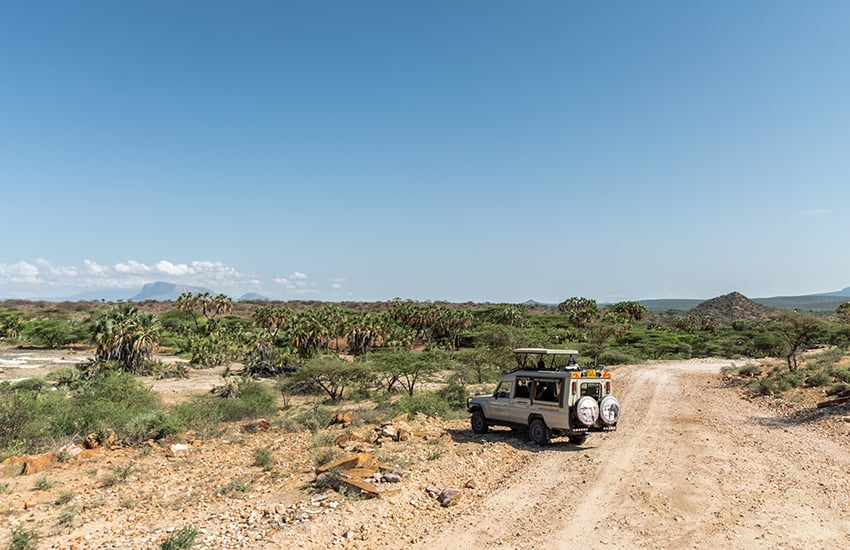
42 Destinations in Isiolo County, arranged as one would visit these - south, north, east then north - with aid of narratives, images, strip maps and distance chart:
Isiolo Town, St. Eusebius Cathedral, Isiolo Jamia Mosque, Isiolo Memorial, Kisimani Eco Resort, Isiolo Falls, Kaita and Degushi Hills, Nyambeni Range, Magado Crater, Cave Dwellings, Harr Girrissa, Mlima Tatu, Kubi Turkana, Garba Tula, Gotu Falls, Gotu Cultural Centre, Biliqo Bulesa Conservancy, Merti Plateau, Merti Catholic Church, Ewaso Nyiro River, Lorian Swamp, Malka Cultural Centre, Bisanadi National Reserve, Kora Wells, Leparua Conservancy, Ol Lentille Conservancy, The Sanctuary at Ol Lentille, Oldonyiro Conservancy, Nantudu Spire Rock, Nasuulu Conservancy, Buffalo Springs National Reserve, Buffalo Springs, Samburu National Reserve, Samburu Simba Lodge, Shaba National Reserve, Sarova Shaba Lodge, Joy’s Camp, Nakuprat Gotu Conservancy, Boji Dera Camp, Sera Conservancy, Isiolo Cultural Festival, Camping in the Great North
Know More About Isiolo County: Its Geography, Land-Use, Highlights, Population, Roads - with the aid of strip maps, Airports, Climate & National Monuments

What’s The Air Like In Isiolo?
Isiolo is almost always hot and dry at most months of year, with a mean of 30oC, and two rainy seasons. The rainfall received is historically erratic, scarce and unreliable.


What’s The Lay Of The Land In C.11?
Isiolo can be split into three ecological zones, semi-arid, arid and very near desert arid. The smallest, useful, semi-arid zone covers only 5% the county, around Kinna region.
