
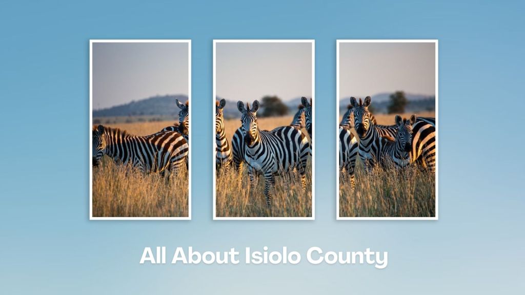
The Middling Nexus


A Summa Digest of Isiolo County
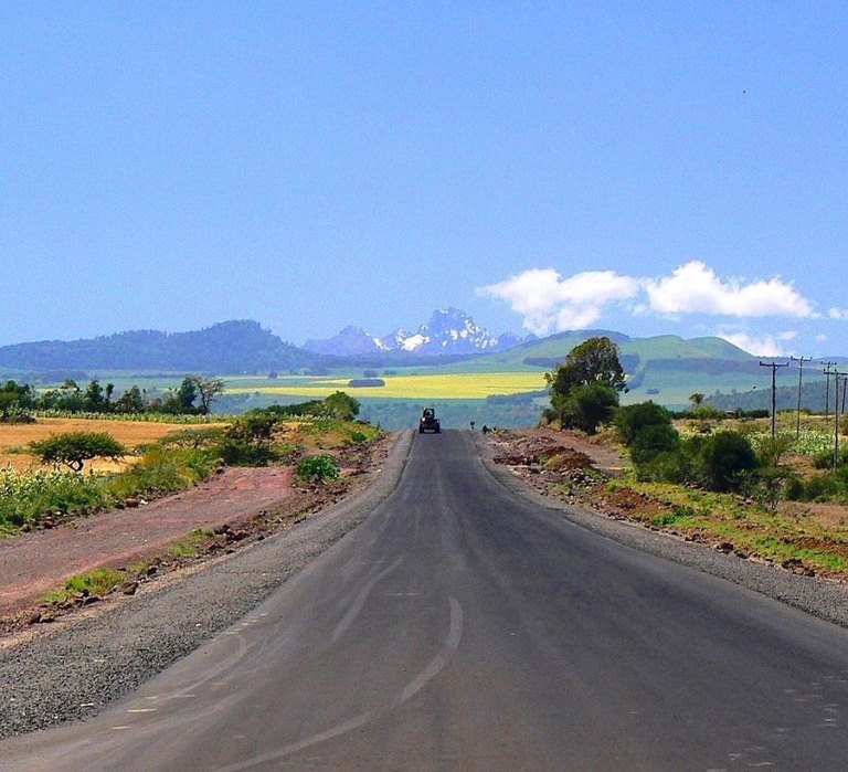
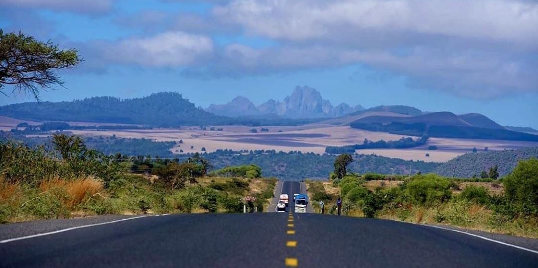
As you cross the peripheral area between Nanyuki and Isiolo towns, the line of hills extending from Mount Kenya spot a memorable view, fading away north as the road suddenly descends Timau Escarpment passing the rolling farms at Timau. Outwith, you begin to wend your way across the semi-arid lower area of Lewa Conservancy. The principal line of communication in Isiolo County, and to its self-same capital of Isiolo, is the A2 international trunk road linking Nairobi to Moyale.
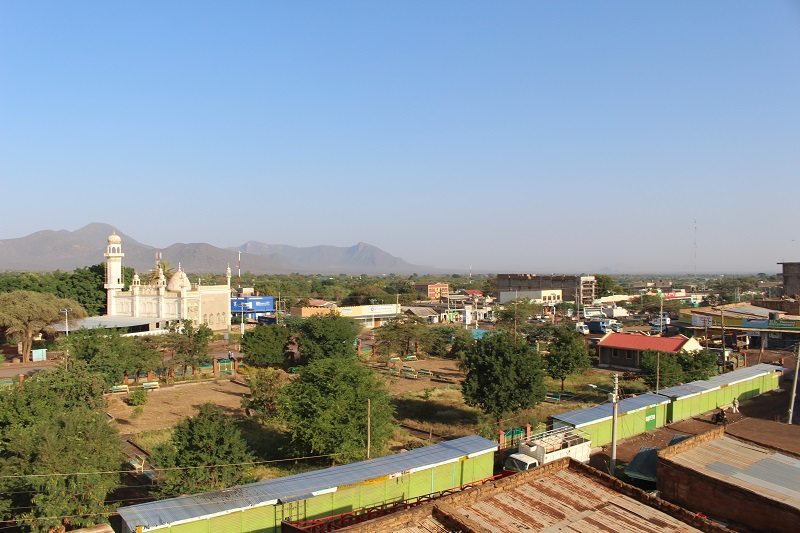
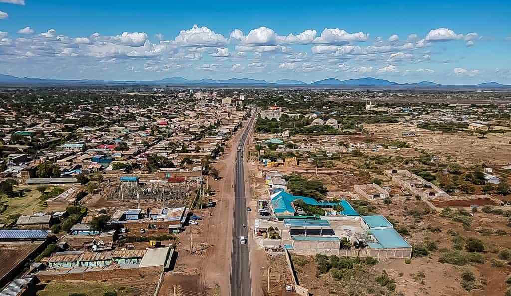
Although subject to seasonality, the large scale wheat farms around Timau, about 27 beyond Nanyuki, march on the surfeit of pleasant landscapes en-route Lewa to near Isiolo town, where the pageant of the bushy plains unfolds, rendering a stark landscape that rarely fails to impress. 79 km from Nanyuki, Isiolo town, the largest in Isiolo County, is reached. All else considered, the vibrant Isiolo town is the most geographically central town in Kenya, strategically accessible from different parts of the country. Its central location has made it a salient political and cultural hub.
Leaving Isiolo town northbound, which borders Leparua Community Conservancy to the west, the gently undulating to flat relief begins its epic domination. West of Isiolo, the hills and slopes also begin to disappear and, as you go further north, the large tableland stands out lordly, beckoning whacking open flat plains. A universal welcome to the fabled Northern Frontier District of Kenya. The fabled North, in its entirety, forms a considerable and lightly populated portion of the country. A flat country with miles upon miles of open country. There are scattered residual hills and uplands, the most notable these being Mount Ololokwe and Mount Marsabit.
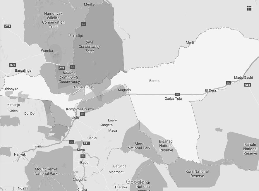
If you are travelling to Isiolo County, or further north, during the drier months of the year, the desolate out-and-out shrubby wilderness plains give the miniature thorn bushes the appearance of moving game and often conceal objects in the far distance. Hot as it may be, the drive is always a wildly beautiful one. Archers Post, situated along along the narrow foreland, along the border with Samburu County, is the last major stop, as the North draws you in; distance from Isiolo town 34 km.
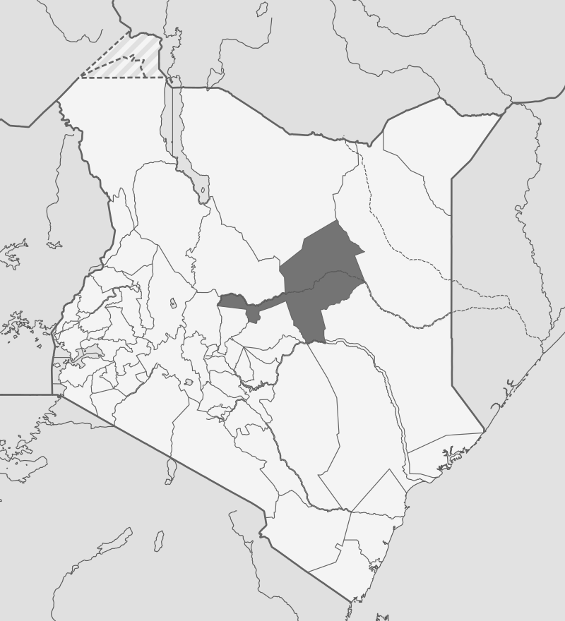
Still, much of the forked-fishtail shaped Isiolo County stretches east of Isiolo town, in similar arid monotone and unvarying wearisomeness of the great North, with Merti, Habaswein, Mado Gashi, and Kora National Park marking its western reach. A secondary road from Isiolo town, the B9 Road, via Garba Tula, Habaswein and Wajir, terminates at Mandera town, the furthest north town in Kenya; distance 715 km. Isiolo County is bordered by Marsabit County to the north, Wajir County to the east, Garissa County to the southeast, Tana River County to the south, Meru County to the southwest, and Laikipia and Samburu Counties to the west; all arid.
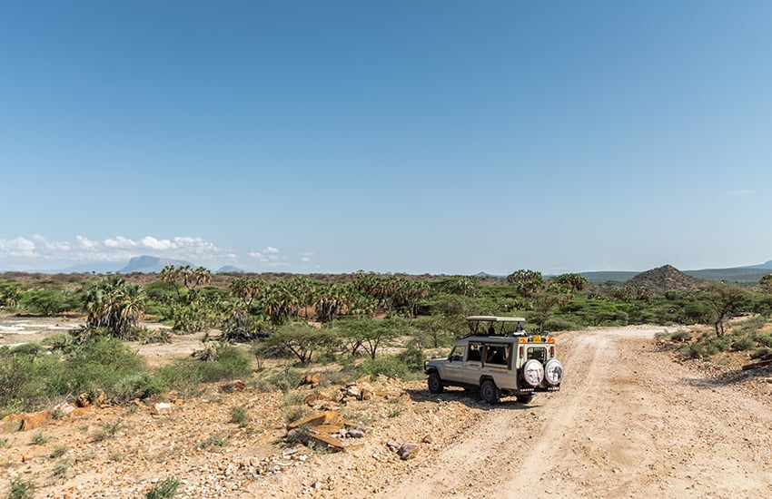
The rangeland between Isiolo and Garba Tula and onwards across the Northern Frontier District may be one of the driest blocks of land in Kenya, yet, what it lacks in water is made up for with striking and unfamiliar horizons which are dominated by the extensive wildlife rich acacia covered plains dotted with secluded craggy hills. From Archers Post, the road north passes through Merille, Marsabit and Turbi before reaching Moyale – 466 kms away; the last town before entering Ethiopia.
Home to several wildlife famed reserves and conservancies, including the Buffalo Springs National Reserve, Shaba National Reserve, a section of the Lewa Wildlife Conservancy, and a collections of newer preserves, Isiolo County is proper safari country, with all necessary amenities including top of the line safari resorts. Over and above its safari prospects, are its people and cultural diversity, with various iconic tribes of Kenya calling this home, including the Borana, Turkana, Samburu, Somali, and Meru. The primary economic foundation among them is pastoralism.
Salient Features of Isiolo County
- County Number 11
- Area – 25700 km2
- Altitude – 3500 ft
- Major Towns – Isiolo, Merti, Garba Tula
- Borders – Marsabit, Samburu, Wajir, Meru, Laikipia, Tharaka Nithi, Tana River
Isiolo County, with its strategic location, rich cultural heritage, and potential for development, is a unique region in Kenya. It features a mix of semi-arid and arid landscapes, with some areas of savannah and bushland, and home to several wildlife reserves and conservancies, including the Buffalo Springs National Reserve, Shaba National Reserve and the famed Lewa Wildlife Conservancy.
You Are Here: Isiolo County
Where to Next?
Explore Destinations in Isiolo County
A Guide to Isiolo County


A Summa Digest of Isiolo

About Isiolo Way Back When

42 Destinations in Isiolo County, arranged as one would visit these - south, north, east then north - with aid of narratives, images, strip maps and distance chart:

Isiolo Town, St. Eusebius Cathedral, Isiolo Jamia Mosque, Isiolo Memorial, Kisimani Eco Resort, Isiolo Falls, Kaita and Degushi Hills, Nyambeni Range, Magado Crater, Cave Dwellings, Harr Girrissa, Mlima Tatu, Kubi Turkana, Garba Tula, Gotu Falls, Gotu Cultural Centre, Biliqo Bulesa Conservancy, Merti Plateau, Merti Catholic Church, Ewaso Nyiro River, Lorian Swamp, Malka Cultural Centre, Bisanadi National Reserve, Kora Wells, Leparua Conservancy, Ol Lentille Conservancy, The Sanctuary at Ol Lentille, Oldonyiro Conservancy, Nantudu Spire Rock, Nasuulu Conservancy, Buffalo Springs National Reserve, Buffalo Springs, Samburu National Reserve, Samburu Simba Lodge, Shaba National Reserve, Sarova Shaba Lodge, Joy’s Camp, Nakuprat Gotu Conservancy, Boji Dera Camp, Sera Conservancy, Isiolo Cultural Festival, Camping in the Great North

Know More About Isiolo County: Its Geography, Land-Use, Highlights, Population, Roads - with the aid of strip maps, Airports, Climate & National Monuments

What’s The Air Like In Isiolo?
Isiolo is almost always hot and dry at most months of year, with a mean of 30oC, and two rainy seasons. The rainfall received is historically erratic, scarce and unreliable.


What’s The Lay Of The Land In C.11?
Isiolo can be split into three ecological zones, semi-arid, arid and very near desert arid. The smallest, useful, semi-arid zone covers only 5% the county, around Kinna region.
