
Irrigation Schemes in Embu


Mwea Rice Scheme: A Rice Basket of Kenya
Kenya is in a time of rapid expansion. Towns, once trivial centres, are reshaping themselves in size, with the good road network capably improved by successive governments over the last decade upending the development. The tailend of B6 Embu-Meru Road, turning off the A2 Nairobi-Isiolo-Moyale Road at Makutano, could be said to possess some burgeoning elements, although the mismatched, informal disposition of these centres have few reasons for the traveller to stop.
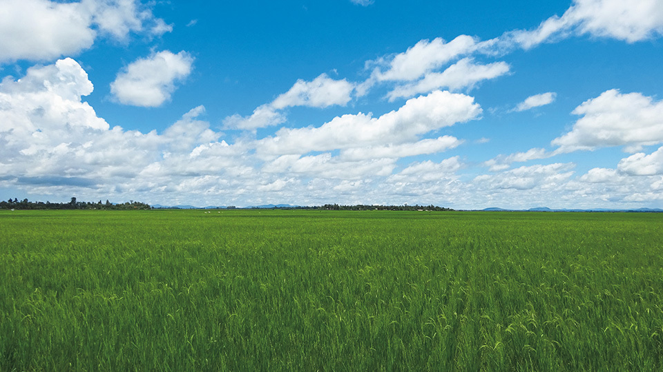
Likewise, the maiden section of B6 Road has little to commend it as it travels through Kirinyaga County enroute Embu town, the gateway into Embu County. Then, 14 km beyond Makutano along the B6, at the third centre, Mutithi, around the bend, a definitively stunning and fetching landscape unfolds. If there is still a debate on the best vantages of Mount Kenya as a matter of travel interest, the view of Mount Kenya, at Mwea Irrigation Scheme, with a dramatic stretch of the unvarying plane of the verdant paddies, is a contender provided in good weather.
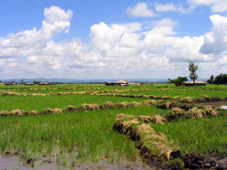
Presently, the terrain levels out into a flat sheet of land, the mountain rising eminently as a jaw-dropping backdrop. The vast 60 km2 Mwea Rice Irrigation Scheme, seen between Mutithi and Wang’uru (Mwea), was instituted in 1953 by the colonial government and handed over to National Board in 1963. Today, it is Kenya’s biggest rice growing project. It covers the southern region of Kirinyaga County. The paddies are sown during the rainy season and are especially worth the look-see between April and July or between November and early December.
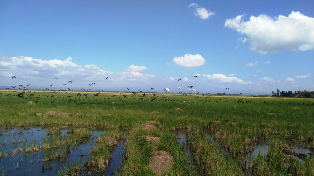
The Mwea Irrigation Scheme relies on a network of canals, dams, and reservoirs to distribute water for rice cultivation. The scheme has helped to transform the arid plains into productive agricultural land, allowing for year-round farming. The Mwea Rice Research Station, located within the scheme, conducts research and development activities aimed at improving rice varieties, farming techniques, and water management practices. The station usually collaborates with local farmers, agricultural experts, and international organizations to enhance productivity.

Kenya has implemented various irrigation schemes to improve agricultural productivity, ensure food security, and promote economic development. Irrigation plays a crucial role in Kenya’s agricultural sector, particularly in areas prone to drought and erratic rainfall, by providing a reliable source of water.
Index of Irrigation Schemes in Kenya


Bomet County - Nogirwet Irrigation Scheme, Chebara Irrigation Scheme, Baringo County - Perkerra Irrigation Scheme, Busia County - Bunyala Irrigation Scheme, Kocholia Irrigation Scheme, Embu County - Kaagari-Gaturi Irrigation Scheme, Mwea Rice Irrigation Scheme, Migori County - Lower Kuja Irrigation Scheme, Lower Sabor Irrigation, Rwabura Irrigation Development Project, Tana River County - Bura Irrigation Development Project, Galana Kulalu Irrigation Development, Turkana County - Turkana Irrigation Irrigation Project, West Pokot County - Wei-wei Irrigation Scheme

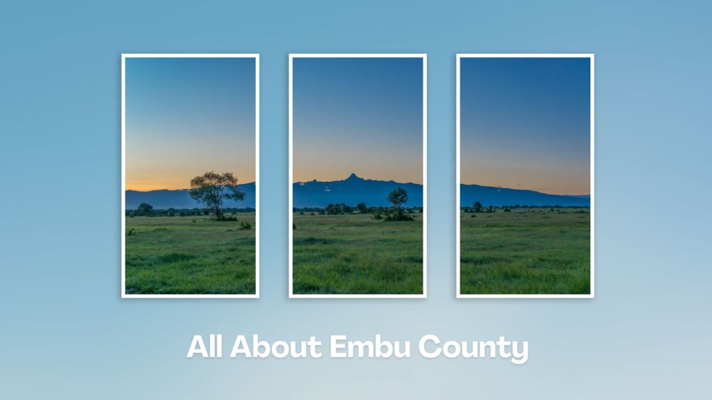
Situated at the base of Mount Kenya, Embu County offers a rich tapestry of cultural heritage, natural beauty, and adventure activities, making it a rewarding destination for travelers seeking an authentic experience in the central highland of Kenya. Engage with the Aembu and Mbeere people, who inhabit the region, and learn about their traditional way of life, like farming practices, music, and dance.
You Are Here: Mwea Irrigation Scheme
Where to Next?
Explore Destinations Near Mwea Irrigation Scheme
A Guide to Embu County


A Summa Digest of Embu

About Embu Way Back When

32 Destinations in Embu County, arranged as one would visit these - south, west, east then south - with the aid of narratives, images, strip maps and distance chart:

Mwea Rice Plains, Ndaraca ya Ngai, Embu Art Centre, Izaak Walton Inn, Iveche Falls, Karunina Falls, Njukiri Forest, Camp Ndunda Falls, Mount Kenya Riverside Retreat, Embu Golf Range, Murinduko Hill Forest, Karue Hill, Kirimiri Forest, Nthenge Njeru Falls, Nthungu Falls, Nthenge Njeru Hiking Trail, Irangi Forest Station, Mzima Fishing Camp, Kaagari-Gaturi Irrigation, Thuci River Lodge, Mbeere Terraces, Kiang’ombe Forest, Mumoni Hill, Kianjiru Hill, Mwea National Reserve, Kamburu Dam, Riakanau Beach, Masinga Dam, Masinga Dam Resort, Gitaru Dam, Kindaruma Dam, Kiambere Dam

Know More About Embu County: Its Geography, Land-Use, Highlights, Population, Roads - with aid of strip maps, Airports, Climate & National Monuments


What’s The Lay Of The Land In C.14?
Embu is exemplified by its sharply defined uplands, lowland and slopes from the north, northwest towards the east and southeast, with a few isolated hills such as Kiambere and Kiang’ombe.

What’s The Air Like In Embu?
Embu has a typical highland profile, on the windward side of Mount Kenya, with cold and wet upper zones to hot and dry lower zones in Tana River Basin. Temperatures range betwixt 20o and 30oC.

