
Geography, Land-Use, Highlights, Population, Roads, Airports, Climate & National Monuments in Bomet County


Geography of Bomet County
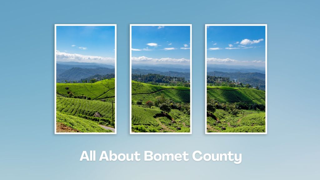
A considerable part of Bomet County is characterized by undulating topography that gives way to a flatter terrain in the south. The overall slope of the land in Bomet County is towards the south, except the north eastern part which rises eastwards towards the 3,000 ms high Mau Ridges.
The land slopes gently from Kericho Plateau to about 1,800 ms in the lower area where the land is flat with a few hills in Chepalungu and Sigor. Chepalungu Sub-county is the largest in land area covering 535.8 km2, followed by Sotik (479.2 km2), Konoin (445 km2) and Bomet East (311.3 km2) then Bomet Central (266).
Land Use in Bomet County
The higher altitudes in the north-eastern region of Bomet County are especially suitable for tea and dairy farming. The middle region of the County which lies 2,300 ms above sea level is suitable for maize, pyrethrum and coffee. The southern region of Bomet, around Sigor and part of Longisa, the main economic activity is livestock, while milk production is a major economic activity in Sotik.
Highlights of Bomet County
Although there are no flourishing touring attraction activities in Bomet County, there exists immense potential for tourism. Part of Bomet County is within the great Mau Forest Complex. Bomet borders a long stretch of Mau Forest which is an indigenous forest harbours a multifarious array of both animals and plants. However, owing to human encroachment, animal life is threatened and certain species of wild animals and plant are almost extant. It has a few pretty falls too.
Population of Bomet County
The population density of Bomet County was 384 / km2 in 2012 – which was expected to grow to 415 / km2 and 437 / km2 in 2015 and 2017. The population was estimated at 723,813 in 2009 per the Population and Housing Census and has similar features as that of the national population growth rate of 3% but with different demographic indicators. Population was estimated at 782,531 in 2012; 846,012 in 2015 and 891,168 by 2017 at an estimated growth rate of 2.7%.
Airports in Bomet County
Bomet County has an air strip located near Bomet Town.
Roads in Bomet County
The total length of road in Bomet County is 7,000 kms of which 237 kms are under bitumen and 1,577.5 kms under gravel and earth surfaces. The bitumen surface is only 3.3 per cent of its total network. Given the heavy rains across Bomet County, roads, particularly gravel and earth surface, become impassable.
Climate in Bomet County
Rainfall is evenly distributed, except for the short dry season in January and February. The wettest months are April and May. Overall, there is little break between short and long rains across the whole county. The temperature levels range from 16o C to 24o C with the coldest months between February and April, while the hot season (generally pleasant) falls between December and January.
National Monuments in Bomet County
There are no designated national monuments in Bomet County.
Touring Bomet County offers a chance to explore the lush landscapes, cultural heritage, and natural attractions of Kenya’s Rift Valley region. Whether you’re interested in nature, culture, or adventure, Bomet offers a diverse range of attractions and activities to explore. It is also a jumping-off place to Masai Mara.
A Guide to Bomet County


A Summa Digest of Bomet

About Bomet Way Back When

20 Destinations in Bomet County, arranged as one would visit these - east, north, south then west - with aid of narratives, images, strip maps and distance chart:

Kipsigis Oasis Sanctuary and Culture, Chepalungu Forest, Nogirwet Irrigation Scheme, Chebara Irrigation Scheme, Kaplelach Cultural Centre, Masese Nyangores Ecotourism, Nyangores River, Masai Mara National Reserve, Fair Hills Hotel, Sahara Gardens Hotel, The Willis Hotel, Tenwek Falls, Motigo Hill, Kipsegon Ecosystem, Tirgaga Tea Factory, Trans Mara Forest, South Western Mau Forest, Iria Maina Falls, Changoi Tea Factory

Know More About Bomet County: Its Geography, Land-Use, Highlights, Population, Roads - including a distance chart, Airports, Climate & National Monuments

What’s The Air Like In Bomet?
Rainfall is evenly distributed in Bomet, except for the short dryer season in January and February. Temperature levels range from 16oC to 24oC with the coldest months between February and April; and July.


What’s The Lay Of The Land In C.36?
Bomet has an undulating topography that gives way to a flatter terrain in the south. The overall slope is towards the south, except the north eastern region – which rises eastwards towards the 3,000 ms Mau Mountain Complex.
