
Attractions in Baringo County


Mogotio Equator Crossing: On Both Sides Now
The customary stop-over at Mogotio Equator Crossing has been a decades old tradition and norm by travellers to Baringo. Situated from 40 km from Nakuru Town, it is for Baringo County what the Iten Viewpoint is to the neighbouring Elgeyo Marakwet County, the universal welcome. Adequate photos at the fabricated model of earth and the Equator beacon are the main highlights.
Almost always hot and dusty at the Mogotio Equator Crossing, it is a poignant nudge that in the immediate north of the North Hemisphere lies one of the driest and arid blocks of land in Kenya – the adulated Northern Frontier District. At the modern Mogotio Equator Information Centre, which is the main development here, travellers can get reliable information about Baringo County and beyond.
From Mogotio Crossing it is easy to make quick detours to nearby Hotel Lomanira, Olduka Valley, Sawaiti Wetland, Mogotio Sisal Farms and Maji Moto before proceeding north to Lakes Bogoria and Baringo National Reserves.
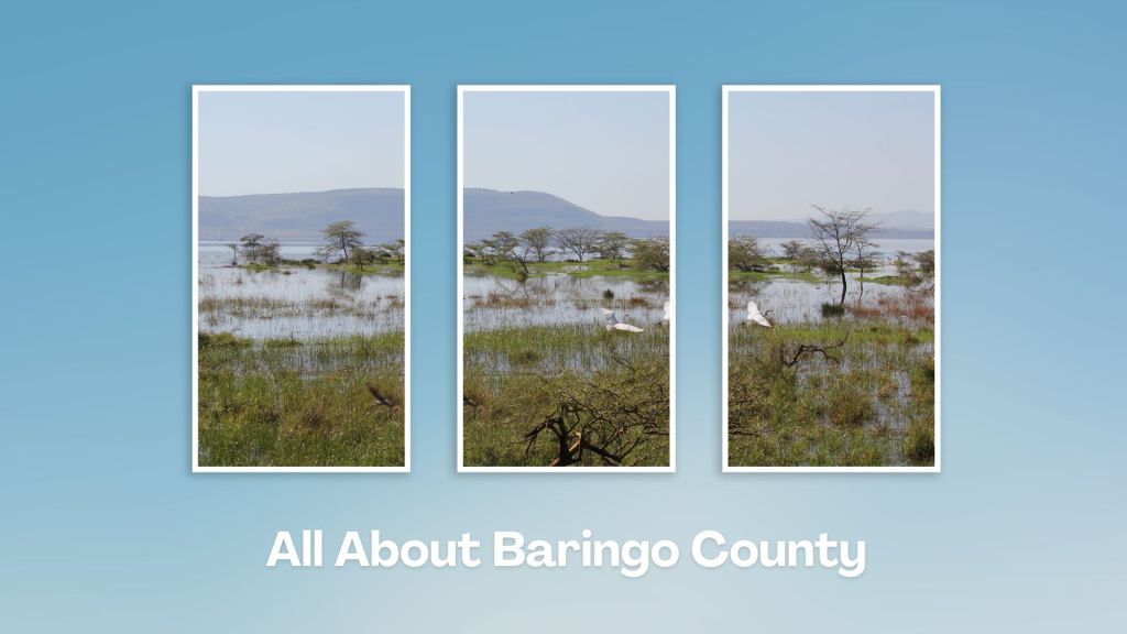
Touring Baringo County offers a unique blend of cultural experiences, natural wonders, and outdoor adventures. Many of its hidden gems, along Kenya’s Rift Valley, create unforgettable memories. Baringo County’s vast ecological gamut is a road-trip lover’s playground, birder’s haven and photographer’s paradise.
You Are Here: Mogotio Equator Station
Where to Next?
Explore Destinations Near Mogotio Equator Crossing
A Guide to Baringo County


A Summa Digest of Baringo

About Baringo Way Back When

52 Destinations in Baringo County, arranged as one would visit these - south, north then south - with the aid of narratives, images, strip maps and distance chart:

Mogotio Equator Crossing, Hotel Lomanira, Olduka Valley, Maji-Moto Hot Springs, Lake Bogoria National Reserve, Lake Bogoria Spa Resort, Loboi Plains, Irong Community Conservancy, Chuine Community Conservancy, Laikipia Escarpment, Perkerra Irrigation Scheme, Lake Baringo National Reserve, Kerubo Swamp, Robert's Camp, Royal Doves Garden, Soi Safari Lodge, Teddy Bear Island, Samatian Island Lodge, Ruko Conservancy, Kaptuya Conservancy, Korosi Volcano, Kabarion Conservancy, Paka Volcano, Nakegere (Kapedo) Falls, Mount Silale, Korongoro Hotel, Lomechan Caves, Daraja ya Mungu, Kimalel Goat Auction, Tugen Hills, Katimok Forest, Kabarnet Museum, Kirandich Dam, Morop Hill, Kikojo Falls, Kimng’ochoch Conservancy, Morop-Tarambas Conservancy, Simot Falls, Releng Hot Springs, Kipsaraman Museum, Kolloa Monument, Lake Kamnarok National Reserve, Chebloch Gorge, Kerio Valley National Reserve, Metkei Ridge, Lembus Forest, Eldama Ravine, St. Swithin’s Church, Koibatek Forest Reserve, Chemususu Dam, Timboroa Railway Station.

Know More About Baringo County: Its Geography, Land-Use, Highlights, Population, Roads - including a distance chart, Airports, Climate & National Monuments


What’s The Lay Of The Land In C.30?
Baringo County varies widely in altitude from 700 ms to 3000 ms. One of the prominent features in Baringo is the Kerio Valley, situated in the western and lowest region.

What’s The Air Like In Baringo?
Temperatures vary from region to region in, ranging from 22 to 35 degrees C. Due to its varied altitudes, the sub-counties in Baringo County receive different levels of rainfall.

