
Wetland Systems in Baringo


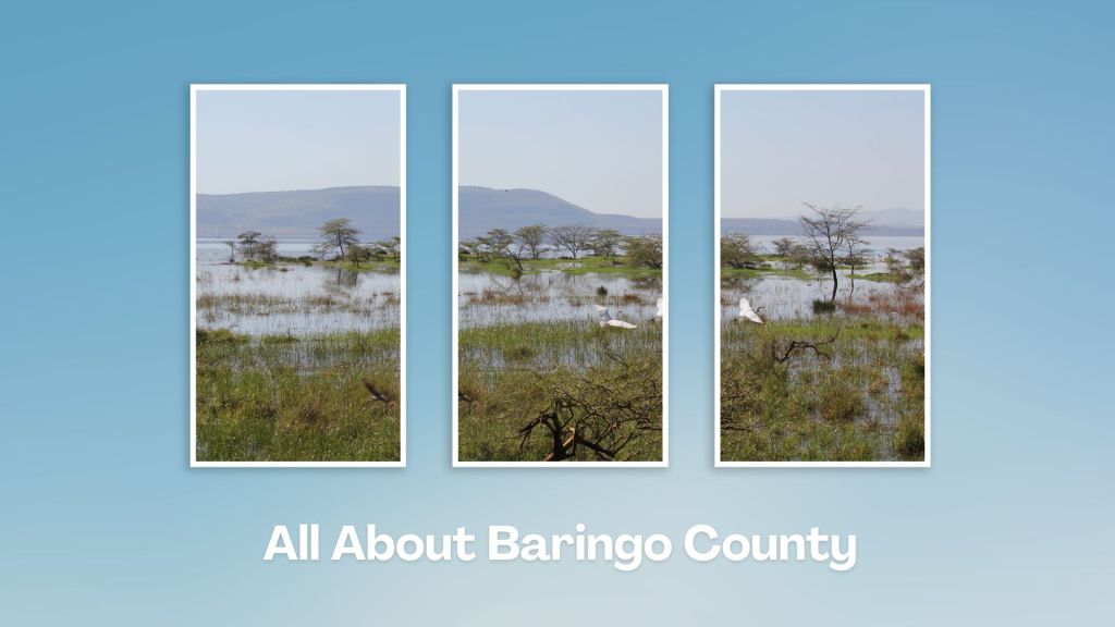
Loboi Plain: An Intriguing Landscape
Crossing the peripheral stretch of Loboi Plains, between Lake Bogoria and Lake Baringo, it’s canny to keep an eye on the Laikipia Escarpment or eastern wall of Rift Valley, seen to the far east and which begins to stretch away further as you close in on Lake Baringo, as it marches north to Lake Logipi.
Loboi Plain, which is a 22 km long and 20 kms wide unvarying plain, on the floor of the Rift Valley is the surface drainage for the two lakes. It was once part of the roomy Lake Kamasia which dwindled to form Lakes Baringo and Bogoria. Lake Baringo has held as a freshwater lake for several centuries in so much as Lake Bogoria has been salty and alkali, covered by the lacustrine salt deposits.
Near Lake Bogoria National Reserve you can visit Loboi Wetland. Here, according to local traditions, the spirit of their traditional deities keep these ‘waters’ side-wise. In fact, the enthusiastic local guides can take you to the exact place these ‘waters’ separate. Some other places of interest include Loboi Swamp found at the northern fringes of Lake Bogoria, the warm springs seen at Lake Bogoria’s midwest, and little-known Chelaba Springs found near Lake Baringo Reserve.

Kenya boasts a variety of wetlands, each offering unique ecological, cultural, and recreational opportunities. Kenya’s lakes along the Rift Valley, like Lake Baringo, Lake Bogoria, and Lake Elementaita, have wetland areas important for resident and migratory birds. All wetlands are important for biodiversity conservation and contribute to local economies through tourism, fishing, and agriculture.
Index of Wetlands in Kenya


Baringo County - Loboi Swamp, Busia County - Yala Swamp, River Sio Siteki Swamp, Budalang'i Delta, Garissa County - Lorian Swamp, Kajiado County - Shompole Swamp, Lake Amboseli, Kiambu County - The Ondiri Swamp, Kilifi County - River Sabaki Delta, Kisumu County - Nyando (Kusa) Wetland, Machakos County - Athi River Basin, Nakuru County - Rift Valley Wetlands, Nandi County - Kingwal Swamp, Narok County - Mara River Arc, Tana River County - Tana River Delta, Taita Taveta County - Kanderi Swamp

Touring Baringo County offers a unique blend of cultural experiences, natural wonders, and outdoor adventures. Many of its hidden gems, along Kenya’s Rift Valley, create unforgettable memories. Baringo County’s vast ecological gamut is a road-trip lover’s playground, birder’s haven and photographer’s paradise.
You Are Here: Loboi Wetland
Where to Next?
Explore Destinations Near Loboi Wetlands
A Guide to Baringo County


A Summa Digest of Baringo

About Baringo Way Back When

52 Destinations in Baringo County, arranged as one would visit these - south, north then south - with the aid of narratives, images, strip maps and distance chart:

Mogotio Equator Crossing, Hotel Lomanira, Olduka Valley, Maji-Moto Hot Springs, Lake Bogoria National Reserve, Lake Bogoria Spa Resort, Loboi Plains, Irong Community Conservancy, Chuine Community Conservancy, Laikipia Escarpment, Perkerra Irrigation Scheme, Lake Baringo National Reserve, Kerubo Swamp, Robert's Camp, Royal Doves Garden, Soi Safari Lodge, Teddy Bear Island, Samatian Island Lodge, Ruko Conservancy, Kaptuya Conservancy, Korosi Volcano, Kabarion Conservancy, Paka Volcano, Nakegere (Kapedo) Falls, Mount Silale, Korongoro Hotel, Lomechan Caves, Daraja ya Mungu, Kimalel Goat Auction, Tugen Hills, Katimok Forest, Kabarnet Museum, Kirandich Dam, Morop Hill, Kikojo Falls, Kimng’ochoch Conservancy, Morop-Tarambas Conservancy, Simot Falls, Releng Hot Springs, Kipsaraman Museum, Kolloa Monument, Lake Kamnarok National Reserve, Chebloch Gorge, Kerio Valley National Reserve, Metkei Ridge, Lembus Forest, Eldama Ravine, St. Swithin’s Church, Koibatek Forest Reserve, Chemususu Dam, Timboroa Railway Station.

Know More About Baringo County: Its Geography, Land-Use, Highlights, Population, Roads - including a distance chart, Airports, Climate & National Monuments


What’s The Lay Of The Land In C.30?
Baringo County varies widely in altitude from 700 ms to 3000 ms. One of the prominent features in Baringo is the Kerio Valley, situated in the western and lowest region.

What’s The Air Like In Baringo?
Temperatures vary from region to region in, ranging from 22 to 35 degrees C. Due to its varied altitudes, the sub-counties in Baringo County receive different levels of rainfall.

