
Forests Reserves in Baringo


Lembus Forest: A Shell Of A Once Magic Forest
One of the rhapsodized about drives in Baringo County is the 41 km stretch from Tenges to Kabarnet. It takes in beautiful forests, hills, valleys and farmlands. The winding road isn’t a busy road, so motorists can enjoy a peaceful ride through the bucolic scenery. Approaching it either from Eldama Ravine or Emening, or from the Nakuru-Sigor Road, the road, cutting into the steep hillside, up and over valleys with wide outwith views, takes to the eastern side of Lembus Forest.
It is a narrow road, barely enough space for two vehicles, and can be hair-raising as you round some sharp bends. But the drive is well-worth the adventure. If approaching from Eldama Ravine, travellers encounter more of Lembus forest, split into three forest blocks – narasha, chemorgok and chemususu. The former is part of Eldama Ravine. Lembus Forest forms the northern part of the catchment area for the Perkerra River which flows through Baringo County into Lake Baringo.
And while the drive is for the most part scenic and relaxing, it is hard for keen keen motorist not to notice the bald patches in the forest, growing bigger with the time. The problems facing Lembus Forest, and its deforestation, is a complex mix of lapses by subsequent administrations and the failure to repeal the oversights.
Long before the woes entangled the management of this forest, it was under the stewardship of the Lembus people, who are closely related to the Tugen people, although this assertion has been rejected by the Lembus themselves. Over the last century, the Lembus people have faced many challenges in both taking ownership of the forest and its management. No one admits of this wrongdoing.
As recent as 2019, members of the Lembus, under the lead of Lembus Council of Elders, were contesting a governmental forest management which, they argued, focused on exploitation and neglected the conservation of the local forests.
The mess begun way back when! In the 1890s, the Lembus people resisted the British entry into Lembus territories, and especially into Lembus Forest. The resistance by the Lembus also coincided with the Nandi Resistance to the British in the late 1890s to 1906. The British officers in Eldama Ravine also accused the Lembus of collusion with their Nandi brothers and cousins to fight the British.
“Lembus Forest” was put under governmental management and used for commercial timber exploitation from the 1910s, under the colonial office. Lembus Forest was awarded to a commercial company for the development of a timber industry while the British conquest of the region was still incomplete.
The subsequent administration of this concession, and the political battles that ensued for control over the management of Lembus, only made things more complicated. Although local forest dwellers, the Lembus, were recognized rights to live there, after Kenya’s independence, they were relocated in areas freed from the forest land, while the forests remained in governmental hands.

Kenya’s vast forest reserves are of immeasurable importance in biodiversity conservation, water regulation, and carbon storage. Collectively, these forests, natural and exotic, cover 2008 km2 or about 3.4% of Kenya’s land surface area, and 15% of the most fertile land. They also provide important recreational and ecotourism opportunities for visitors to enjoy Kenya’s natural beauty and wildlife.
Index of National Forests & Forests Reserves in Kenya


Baringo County - Tugen Hills Forest, Lembus Forest, Koibatek Forest, Bomet County - Chepalungu Forest, Trans Mara Forest, South Western Mau Forest Reserve, Bungoma County - Chepkitale Forest, Busia County - Budalang'i Forest, Elgeyo Marakwet County - Bugar Forest, Kessup Forest, Embobut Forest, Cherangani Hills Forest Reserve, Embu County - Njukiri Forest, Murinduko Hill Forest, Kirimiri Forest, Kiangombe Forest, Irangi Forest, Homa Bay County - Gwassi Hills Forest, The Kodera Forest, Kakamega County - Kakamega Forest Reserve, Kisere Forest, Malava Forest, Kericho County - Mau Forest Complex, Masaita Forest, Kiambu County - Kinale Forest, Kereita Forest, Kilifi County - Arabuko Sokoke Forest Reserve, Mwangea Hill Forest, Dakatcha Woodland, Kirinyaga County - Murinduko Forest, Njukiini Forest, Kisii County - The Nyangweta Forest, Kitui County - Mumoni Hill Forest Reserve, Muvaroa Hill Forest Reserve, Laikipia County - Marmanet Forest Reserve, Mukogodo Forest, Lamu County - Witu Forest, The Dodori Forest, Boni-Lungi Forest, Machakos County - Iveti Forest Reserve, Makueni County - Kibwezi Forest Station, Marsabit County - Marsabit National Reserve, The Turbi Forest, Meru County - Giitune Sacred Forest, Mucheene Forest, Mpogoro Forest, Ngaya Forest, Nyambane Hill Forest, Ngare Ndare Forest, Muranga County - Aberdare Forest Station, Nairobi County - Ngong Forest, The Karura Forest, Nandi County - South Nandi Forest, North Nandi Forest, North Tinderet Reserve, Nyandarua County - Nyandarua Forest, Dundori Forest, Samburu County - Kirisia Forest, Taita Taveta County - Ngangao Forest, Vuria Hill, Fururu Forest, Tharaka Nithi Forest - Chuka Forest Station, Vihiga County - Nganyi Forest, Kaimosi Forest, The Kibiri Forest, West Pokot County - Kamatira Forest

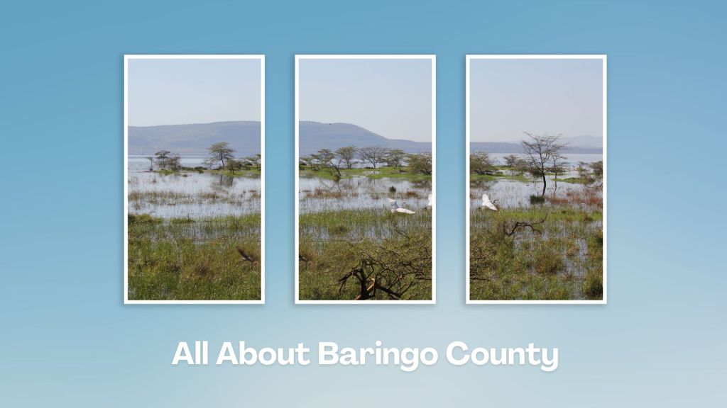
Touring Baringo County offers a unique blend of cultural experiences, natural wonders, and outdoor adventures. Many of its hidden gems, along Kenya’s Rift Valley, create unforgettable memories. Baringo County’s vast ecological gamut is a road-trip lover’s playground, birder’s haven and photographer’s paradise.
You Are Here: Lembus Forest
Where to Next?
Explore Destinations Near Lembus Forest
A Guide to Baringo County


A Summa Digest of Baringo

About Baringo Way Back When

52 Destinations in Baringo County, arranged as one would visit these - south, north then south - with the aid of narratives, images, strip maps and distance chart:

Mogotio Equator Crossing, Hotel Lomanira, Olduka Valley, Maji-Moto Hot Springs, Lake Bogoria National Reserve, Lake Bogoria Spa Resort, Loboi Plains, Irong Community Conservancy, Chuine Community Conservancy, Laikipia Escarpment, Perkerra Irrigation Scheme, Lake Baringo National Reserve, Kerubo Swamp, Robert's Camp, Royal Doves Garden, Soi Safari Lodge, Teddy Bear Island, Samatian Island Lodge, Ruko Conservancy, Kaptuya Conservancy, Korosi Volcano, Kabarion Conservancy, Paka Volcano, Nakegere (Kapedo) Falls, Mount Silale, Korongoro Hotel, Lomechan Caves, Daraja ya Mungu, Kimalel Goat Auction, Tugen Hills, Katimok Forest, Kabarnet Museum, Kirandich Dam, Morop Hill, Kikojo Falls, Kimng’ochoch Conservancy, Morop-Tarambas Conservancy, Simot Falls, Releng Hot Springs, Kipsaraman Museum, Kolloa Monument, Lake Kamnarok National Reserve, Chebloch Gorge, Kerio Valley National Reserve, Metkei Ridge, Lembus Forest, Eldama Ravine, St. Swithin’s Church, Koibatek Forest Reserve, Chemususu Dam, Timboroa Railway Station.

Know More About Baringo County: Its Geography, Land-Use, Highlights, Population, Roads - including a distance chart, Airports, Climate & National Monuments


What’s The Lay Of The Land In C.30?
Baringo County varies widely in altitude from 700 ms to 3000 ms. One of the prominent features in Baringo is the Kerio Valley, situated in the western and lowest region.

What’s The Air Like In Baringo?
Temperatures vary from region to region in, ranging from 22 to 35 degrees C. Due to its varied altitudes, the sub-counties in Baringo County receive different levels of rainfall.

