
Major Towns in Baringo County


Eldama Ravine: A Gateway Into Baringo
Known for its scenic upland landscapes, fertile perennial farmland, and proximity to the Kerio Valley National Reserve, in the southwestern part of Baringo County, Eldama Ravine has stunning natural beauty of the Rift Valley, in addition to hills, valleys, and escarpments, which provide opportunities for outdoor activities.
It serves as a commercial and administrative center for Koibatek, providing services, schools, and markets for the local population, and with good amenities, makes for a useful stop to stretch, have a meal or refill supplies. A nexus between tourism and agriculture, Eldama Ravine is the jumping-off place to Baringo, Uasin Gishu, Elgeyo Marakwet and Nakuru counties, and either route to or from here is a fine treat for travellers who enjoy less busy and scenic routes.
Ravine is part of a region that is not only significant for its natural beauty but also its role in Kenya’s agricultural and energy sectors. Today, the area around Eldama Ravine is home to various ethnic groups, including the Tugen and Pokot people, each with its own unique traditions and cultures. The main tribes in the area are the Tugen who inhabit much of Baringo, and the closely related Elgeyo and Nandi, who inhabit much of Elgeyo Marakwet and Uasin Gishu, respectively.
The lesser tribes are the Njemps, who live more in the extreme north on the low ground north and east of Marigat where a few Pokot from the north are also found. The Tugen and Elgeyo (Kalenjin sub-tribes) can be split into hill dwellers and lowland dwellers by an accident of geography rather than ethnic grounds.
The growth of Ravine was the result of it becoming a small railway halting point and the headquarters of a much larger district of the then Uganda Protectorate. Rather interestingly, is that Ravine area was once part of Nakuru County, an error resulting from many changes in its boundaries when it was the main town for the laying of Kenya to Uganda Railway where it’s origins are rooted, and Kabarnet, its current capital, a very new and minor substation to Eldama Ravine.
Further back in history, Eldama Ravine was first known as Shimoni, thanks to the presence of a ravine through which the Eldama Ravine River flows. Eldama, the non-English part of the name, is derived from the Maasai word ‘eldama’, which means narrow gorge. This steep-sided gorge cut by the Eldama River, about 2 km north of the town, and which, when joined by the Chemususu River a few kilometres downstream, is nearly 1,000 feet deep, with precipitous sides.
Rally enthusiasts and motorists best know Ravine for the legendary “Tugumoi Down” which is a 40 km run down into the Kerio Valley through Tugumoi and Sigoro terminating near Tenges and the Kenya Fluorspar Company at Kimwarer.
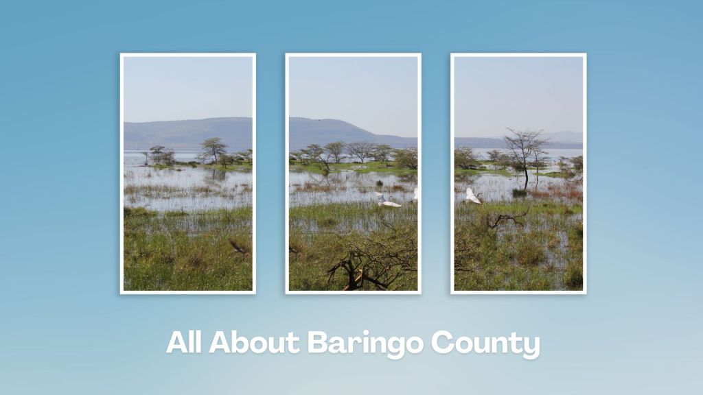
Touring Baringo County offers a unique blend of cultural experiences, natural wonders, and outdoor adventures. Many of its hidden gems, along Kenya’s Rift Valley, create unforgettable memories. Baringo County’s vast ecological gamut is a road-trip lover’s playground, birder’s haven and photographer’s paradise.
You Are Here: Eldama Ravine
Where to Next?
Explore Destinations Near Eldama Ravine
A Guide to Baringo County


A Summa Digest of Baringo

About Baringo Way Back When

52 Destinations in Baringo County, arranged as one would visit these - south, north then south - with the aid of narratives, images, strip maps and distance chart:

Mogotio Equator Crossing, Hotel Lomanira, Olduka Valley, Maji-Moto Hot Springs, Lake Bogoria National Reserve, Lake Bogoria Spa Resort, Loboi Plains, Irong Community Conservancy, Chuine Community Conservancy, Laikipia Escarpment, Perkerra Irrigation Scheme, Lake Baringo National Reserve, Kerubo Swamp, Robert's Camp, Royal Doves Garden, Soi Safari Lodge, Teddy Bear Island, Samatian Island Lodge, Ruko Conservancy, Kaptuya Conservancy, Korosi Volcano, Kabarion Conservancy, Paka Volcano, Nakegere (Kapedo) Falls, Mount Silale, Korongoro Hotel, Lomechan Caves, Daraja ya Mungu, Kimalel Goat Auction, Tugen Hills, Katimok Forest, Kabarnet Museum, Kirandich Dam, Morop Hill, Kikojo Falls, Kimng’ochoch Conservancy, Morop-Tarambas Conservancy, Simot Falls, Releng Hot Springs, Kipsaraman Museum, Kolloa Monument, Lake Kamnarok National Reserve, Chebloch Gorge, Kerio Valley National Reserve, Metkei Ridge, Lembus Forest, Eldama Ravine, St. Swithin’s Church, Koibatek Forest Reserve, Chemususu Dam, Timboroa Railway Station.

Know More About Baringo County: Its Geography, Land-Use, Highlights, Population, Roads - including a distance chart, Airports, Climate & National Monuments


What’s The Lay Of The Land In C.30?
Baringo County varies widely in altitude from 700 ms to 3000 ms. One of the prominent features in Baringo is the Kerio Valley, situated in the western and lowest region.

What’s The Air Like In Baringo?
Temperatures vary from region to region in, ranging from 22 to 35 degrees C. Due to its varied altitudes, the sub-counties in Baringo County receive different levels of rainfall.

