
Reservoir Dams in Baringo


Chemususu Dam: Breathing Hope and Sights
Dams are often overlooked sites in Kenya’s touring circuit. But besides their crucial role in water management, electricity generation and supporting farming, most dams around Kenya are genuinely attractive sites, making many people want to tour them. Deep within the forests of Baringo sits Chemususu Dam.
Completed in 2014, 15 km northwest of Eldama Ravine via B53 Ravine-Eldoret Road, it is the third largest dam in Kenya, after Ndakaini and Sasumua Dams. The 4.5 km long dam (251 acres) Chemususu Dam, bolstered by a 45 m high masonry dam, with a capacity of 11 million m3 of water. set against a backdrop of rolling and wooded hills, is a wonderful location for some picturesque walks.
Constructed within the indigenous Chemususu Forest, it makes for a great sight from a distance but is even more pleasing when explored at close quarters. Another way to comprehend the beauty of Chemususu Dam is to get involved in the annual Chemususu Dam Marathon, whose invigorating 21 km course loops around the dam. It is usually held in the first half of November.
Chemususu Dam caters for close to 600,000 residents of Eldama Ravine and the surrounding region. It receives water through forest surface runoff and Barain and Sawich rivers. It is just one example of the numerous dams and reservoirs in Kenya and other countries that play a crucial role in water conservation.
“This project marks the finish of one of the millennium goals of increasing water supply in Kenya and it is the largest project done within the Rift Valley region.”
These structures are vital for the sustainable development and economic growth of regions like Baringo County and the broader Rift Valley area. The dam and its surrounding area may have environmental significance: Dams and reservoirs create opportunities for biodiversity conservation and can support wetlands.

Kenya has several reservoir dams that play a consequential roles in water supply, hydroelectric power generation, irrigation, flood control, and other water-related activities. The most famous of these are Seven Forks Dams along the Tana River. While reservoir dams are critical infrastructure projects that contribute to Kenya’s economic development, they are also visually stunning go-to destinations.
Index of Dams in Kenya


Baringo County - Chemususu Dam, Kirandich Dam, Bungoma County - Chwele Dam, Muyayi Dam, Makhonge Dam, Kabuchai Dam, Elgeyo Marakwet County - Kimwarer Dam, Arrow Dam, Chebara Dam, Embu County - Gitaru Dam, Kamburu Dam, Masinga Dam, Kiambere Dam, Kindaruma Dam, Kajiado County - The Kiserian Dam, Kericho County - Chemusot Dam, Dimbolil Dam, Londiani Dam, Kiambu County - Ruiru Dam, Thika Dam, Kirinyaga County - Thiba Dam, Kwale County - The Mukurumudzi Dam, Nyalani Dam, Machakos County - Maruba Dam, Makueni County - The Mulima Dam, Mannoni Dam, Katilini, Ndukuma Dam, Thwake Dam, Migori County - Kebharisia Dam, Muranga County - The Ndakaini Dam, Maragua Dam, Mathioya Dam, Nairobi County - Nairobi Dam, Nyamira County - Bonyunyu Dam, Nyandarua County - Matches Dam, Sasamua Dam, Nyahururu Dam, Nyeri County - Chinga Dam, Wanjii Dam, Uasin Gishu County - Kesses Dam, Two Rivers Dam, West Pokot County - The Turkwel Gorge Dam

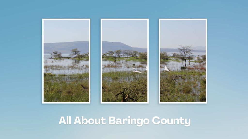
Touring Baringo County offers a unique blend of cultural experiences, natural wonders, and outdoor adventures. Many of its hidden gems, along Kenya’s Rift Valley, create unforgettable memories. Baringo County’s vast ecological gamut is a road-trip lover’s playground, birder’s haven and photographer’s paradise.
You Are Here: Chemususu Dam
Where to Next?
Explore Destinations Near Chemususu Dam
A Guide to Baringo County


A Summa Digest of Baringo

About Baringo Way Back When

52 Destinations in Baringo County, arranged as one would visit these - south, north then south - with the aid of narratives, images, strip maps and distance chart:

Mogotio Equator Crossing, Hotel Lomanira, Olduka Valley, Maji-Moto Hot Springs, Lake Bogoria National Reserve, Lake Bogoria Spa Resort, Loboi Plains, Irong Community Conservancy, Chuine Community Conservancy, Laikipia Escarpment, Perkerra Irrigation Scheme, Lake Baringo National Reserve, Kerubo Swamp, Robert's Camp, Royal Doves Garden, Soi Safari Lodge, Teddy Bear Island, Samatian Island Lodge, Ruko Conservancy, Kaptuya Conservancy, Korosi Volcano, Kabarion Conservancy, Paka Volcano, Nakegere (Kapedo) Falls, Mount Silale, Korongoro Hotel, Lomechan Caves, Daraja ya Mungu, Kimalel Goat Auction, Tugen Hills, Katimok Forest, Kabarnet Museum, Kirandich Dam, Morop Hill, Kikojo Falls, Kimng’ochoch Conservancy, Morop-Tarambas Conservancy, Simot Falls, Releng Hot Springs, Kipsaraman Museum, Kolloa Monument, Lake Kamnarok National Reserve, Chebloch Gorge, Kerio Valley National Reserve, Metkei Ridge, Lembus Forest, Eldama Ravine, St. Swithin’s Church, Koibatek Forest Reserve, Chemususu Dam, Timboroa Railway Station.

Know More About Baringo County: Its Geography, Land-Use, Highlights, Population, Roads - including a distance chart, Airports, Climate & National Monuments


What’s The Lay Of The Land In C.30?
Baringo County varies widely in altitude from 700 ms to 3000 ms. One of the prominent features in Baringo is the Kerio Valley, situated in the western and lowest region.

What’s The Air Like In Baringo?
Temperatures vary from region to region in, ranging from 22 to 35 degrees C. Due to its varied altitudes, the sub-counties in Baringo County receive different levels of rainfall.

