
Geography, Land-Use, Highlights, Population, Roads, Airports, Climate & National Monuments in Baringo County


Geography of Baringo County
Baringo County varies widely in altitude from 700 ms to 3000 ms. One of the prominent features in Baringo is the Kerio Valley, situated in the western and lowest region. The eastern part of Baringo, where Lakes Baringo and Bogoria are found, as well as, the Loboi Plains form its middle region of flatter ground. Tugen Hills and Cherangani Range on the western part form the highland zone.
Land Use in Baringo County
Baringo County can be split into two generalized ecological zones: the highlands and the lowlands. In the highlands, like Tugen Hills, agriculture in the main economic activity with coffee, cereals and fruits being cultivated in the fertile and well drained soils. In the low land arid areas, agriculture in lesser in scale and more subsistence with livestock and bee-keeping more prevalent. These areas include Kollowa and Marigat. Owing to the precipitous terrain in Baringo County, 45% of the land is too steep for tillage, and 35% of the land is semi arid.
Highlights of Baringo County
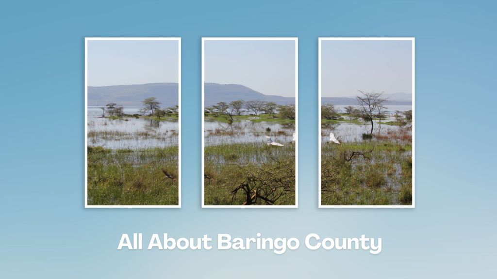
The bubbling water, hot-springs and gushing geysers, flamingos and ostriches are among the major attraction at Lake Bogoria and at Kapedo Springs. Some of its lesser known destinations include its beautiful forests such as Tugen Hills, Tenges, Kabarnet, Katimok and Saimo Forest, which present opportunities for those who like the roads less travelled. Lake Baringo which has 13 islands and many viewpoints is always a treat for visitors to Baringo and it has great resorts.
Population of Baringo County
The population density for Baringo County, based on the 2009 census, was 50 people / km2, estimated to rise to 60 people / km2 in 2017 – translating to a population of 723,411 up from 552,561 in 2009. East Pokot SC has the highest population while Mogotio has the least population. Many of the people living in Baringo are from the Tugen Tribe. The major towns are Ravine and Kabarnet.
Airports in Baringo County
Baringo County has 4 airstrips.
Roads in Baringo County
With the exception of its main roads connecting major towns, Baringo County does not have a good road network. It has a total of 2911 kms of roads with only 339 being bitumenized. 1,810 kms are gravel and the rest are earth type roads.
Climate in Baringo County
Due to its varied altitudes, the sub-counties in Baringo County receive different levels of rainfall, with Koibatek receiving the highest rainfall, while East Pokot, Mogotio and Baringo North receive the lowest rainfall. Equally, temperatures vary from region to region in Baringo County, ranging from 22 to 35 degrees C.
National Monuments in Baringo County
There are no designated national monuments in Baringo County.
Touring Baringo County offers a unique blend of cultural experiences, natural wonders, and outdoor adventures. Many of its hidden gems, along Kenya’s Rift Valley, create unforgettable memories. Baringo County’s vast ecological gamut is a road-trip lover’s playground, birder’s haven and photographer’s paradise.
A Guide to Baringo County


A Summa Digest of Baringo

About Baringo Way Back When

52 Destinations in Baringo County, arranged as one would visit these - south, north then south - with the aid of narratives, images, strip maps and distance chart:

Mogotio Equator Crossing, Hotel Lomanira, Olduka Valley, Maji-Moto Hot Springs, Lake Bogoria National Reserve, Lake Bogoria Spa Resort, Loboi Plains, Irong Community Conservancy, Chuine Community Conservancy, Laikipia Escarpment, Perkerra Irrigation Scheme, Lake Baringo National Reserve, Kerubo Swamp, Robert's Camp, Royal Doves Garden, Soi Safari Lodge, Teddy Bear Island, Samatian Island Lodge, Ruko Conservancy, Kaptuya Conservancy, Korosi Volcano, Kabarion Conservancy, Paka Volcano, Nakegere (Kapedo) Falls, Mount Silale, Korongoro Hotel, Lomechan Caves, Daraja ya Mungu, Kimalel Goat Auction, Tugen Hills, Katimok Forest, Kabarnet Museum, Kirandich Dam, Morop Hill, Kikojo Falls, Kimng’ochoch Conservancy, Morop-Tarambas Conservancy, Simot Falls, Releng Hot Springs, Kipsaraman Museum, Kolloa Monument, Lake Kamnarok National Reserve, Chebloch Gorge, Kerio Valley National Reserve, Metkei Ridge, Lembus Forest, Eldama Ravine, St. Swithin’s Church, Koibatek Forest Reserve, Chemususu Dam, Timboroa Railway Station.

Know More About Baringo County: Its Geography, Land-Use, Highlights, Population, Roads - including a distance chart, Airports, Climate & National Monuments


What’s The Lay Of The Land In C.30?
Baringo County varies widely in altitude from 700 ms to 3000 ms. One of the prominent features in Baringo is the Kerio Valley, situated in the western and lowest region.

What’s The Air Like In Baringo?
Temperatures vary from region to region in, ranging from 22 to 35 degrees C. Due to its varied altitudes, the sub-counties in Baringo County receive different levels of rainfall.

