


Discover the Counties of Kenya
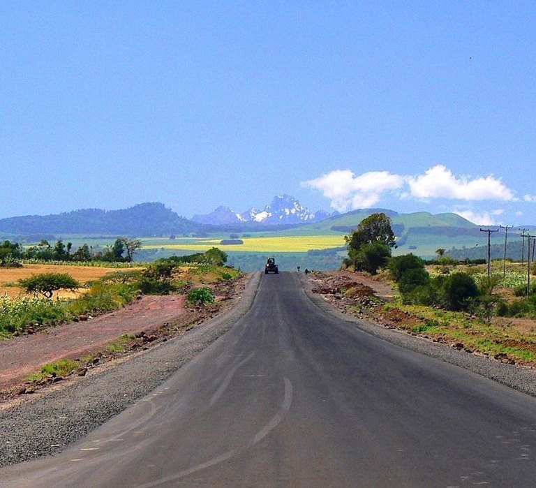
Each County of Kenya holds the promise of unique and memorable adventures – in abundance. One is assured that in any direction they take around Kenya, great experience awaits. The original 40 boundaries of Kenya, marking districts and provinces, were first defined in the 1963 Independence Constitution and they were largely based on ethnic boundaries, affirmed by political positions taken at the Lancaster House Conferences. Between 1968 to 1989, seven new districts were created. In 2010, the 47 Districts were replaced by the 47 Counties of Kenya in accordance to the August 05, referendum. Rather uniquely, nearly all counties of Kenya are named after their largest town that also serves as the capital town.
About 80% of Kenya’s land surface area is classifies as arid to semi-arid, swayed by the enigmatic pastoralist communities. Most of the heavily populated counties of Kenya are located away from these arid and semi-arid zones and confined to an area of about 20% of Kenya. Almost 70% of the Kenya’s population live in the constellation of small counties in the Central and Western. In Central Kenya, Kiambu, Nairobi, Nyeri, Meru, Embu, Kirinyaga and Muranga. In Western Kenya, Bomet, Bungoma, Kericho, Kakamega, Trans Nzioa, Uasin Gishu, Migori and Siaya. Other regions with a sizeable population lie along the Great Rift Valley region.
Peneplains scape a huge part of Kenya. Vast wide-open plains of flat country, accounting for almost 50% of the land in Kenya, including the famed Masai Mara National Reserve, Tsavo and Amboseli National Parks, continue unbroken for hundreds of kilometres. All the large counties of Kenya, which happen to be the least populated, lie within this semi-arid landscape. These include Baringo, Garissa, Mandera, Isiolo, Kajiado, Kitui, Laikipia, Marsabit, Samburu, Tana River, Turkana, Wajir and West Pokot. In the extremity, the semi-arid country gives way to treacherous arid wildernesses epitomized by the Chalbi Desert, in Marsabit.
Baringo County: Jewel of Faunal Beauty
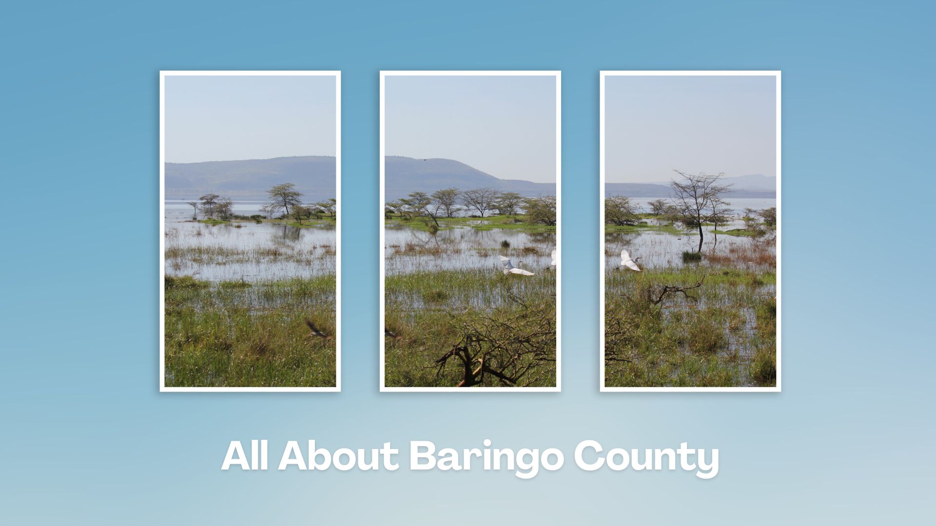


Touring Baringo County offers a unique blend of cultural experiences, natural wonders, and outdoor adventures. Many of its hidden gems, along Kenya’s Rift Valley, create unforgettable memories. Baringo County’s vast ecological gamut is a road-trip lover’s playground, birder’s haven and photographer’s paradise.
A Guide to Baringo County


A Summa Digest of Baringo

About Baringo Way Back When

52 Destinations in Baringo County, arranged as one would visit these - south, north then south - with the aid of narratives, images, strip maps and distance chart:

Mogotio Equator Crossing, Hotel Lomanira, Olduka Valley, Maji-Moto Hot Springs, Lake Bogoria National Reserve, Lake Bogoria Spa Resort, Loboi Plains, Irong Community Conservancy, Chuine Community Conservancy, Laikipia Escarpment, Perkerra Irrigation Scheme, Lake Baringo National Reserve, Kerubo Swamp, Robert's Camp, Royal Doves Garden, Soi Safari Lodge, Teddy Bear Island, Samatian Island Lodge, Ruko Conservancy, Kaptuya Conservancy, Korosi Volcano, Kabarion Conservancy, Paka Volcano, Nakegere (Kapedo) Falls, Mount Silale, Korongoro Hotel, Lomechan Caves, Daraja ya Mungu, Kimalel Goat Auction, Tugen Hills, Katimok Forest, Kabarnet Museum, Kirandich Dam, Morop Hill, Kikojo Falls, Kimng’ochoch Conservancy, Morop-Tarambas Conservancy, Simot Falls, Releng Hot Springs, Kipsaraman Museum, Kolloa Monument, Lake Kamnarok National Reserve, Chebloch Gorge, Kerio Valley National Reserve, Metkei Ridge, Lembus Forest, Eldama Ravine, St. Swithin’s Church, Koibatek Forest Reserve, Chemususu Dam, Timboroa Railway Station.

Know More About Baringo County: Its Geography, Land-Use, Highlights, Population, Roads - including a distance chart, Airports, Climate & National Monuments

Bomet County: Farmland Fair-Country


Touring Bomet County offers a chance to explore the lush landscapes, cultural heritage, and natural attractions of Kenya’s Rift Valley region. Whether you’re interested in nature, culture, or adventure, Bomet offers a diverse range of attractions and activities to explore. It is also a jumping-off place to Masai Mara.
A Guide to Bomet County


A Summa Digest of Bomet

About Bomet Way Back When

20 Destinations in Bomet County, arranged as one would visit these - east, north, south then west - with aid of narratives, images, strip maps and distance chart:

Kipsigis Oasis Sanctuary and Culture, Chepalungu Forest, Nogirwet Irrigation Scheme, Chebara Irrigation Scheme, Kaplelach Cultural Centre, Masese Nyangores Ecotourism, Nyangores River, Masai Mara National Reserve, Fair Hills Hotel, Sahara Gardens Hotel, The Willis Hotel, Tenwek Falls, Motigo Hill, Kipsegon Ecosystem, Tirgaga Tea Factory, Trans Mara Forest, South Western Mau Forest, Iria Maina Falls, Changoi Tea Factory

Know More About Bomet County: Its Geography, Land-Use, Highlights, Population, Roads - including a distance chart, Airports, Climate & National Monuments
Bungoma County: Hub of Diversity


Touring Bungoma County a rich cultural and natural experience. Visit the local villages to experience traditional Luhya culture, including music, dance, and food. The Luhya are known for their vibrant cultural heritage. Around Bungoma County are many great spots for photography and to appreciate the nature’s beauty.
A Guide to Bungoma County


A Summa Digest of Bungoma

About Bungoma Way Back When

26 Destinations in Bungoma County, arranged as one would visit these - north, south east then west - with aid of narratives, images, strip maps and distance chart:

Mount Elgon National Reserve, Elephants Maternity Ward, Chepkitale Forest, Kaptama Viewpoint, Chemoge High Altitude Training Camp, Bukusu Cultural Centre, Maeni Shrine, Namunyu Cave, Daraja la Mungu, Malakisi Falls, Kabuchai Hills, Teremi Falls, Chwele Market, Muyayi Dam, Luucho Hills, Musikoma Hills, Hunters Paraside Cottages, Bungoma Sports Club, Mwibale wa Mwanja, Buteyo Miti Park, Sangalo Rocks, Chetambe Fort, Old Webuye Mills, Nabuyole Falls, Kumfunje Bridge, Mwikhupo Falls

Know More About Bungoma County: Its Geography, Land-Use, Highlights, Population, Roads, Airports, Climate & National Monuments
Busia County: End of the Road
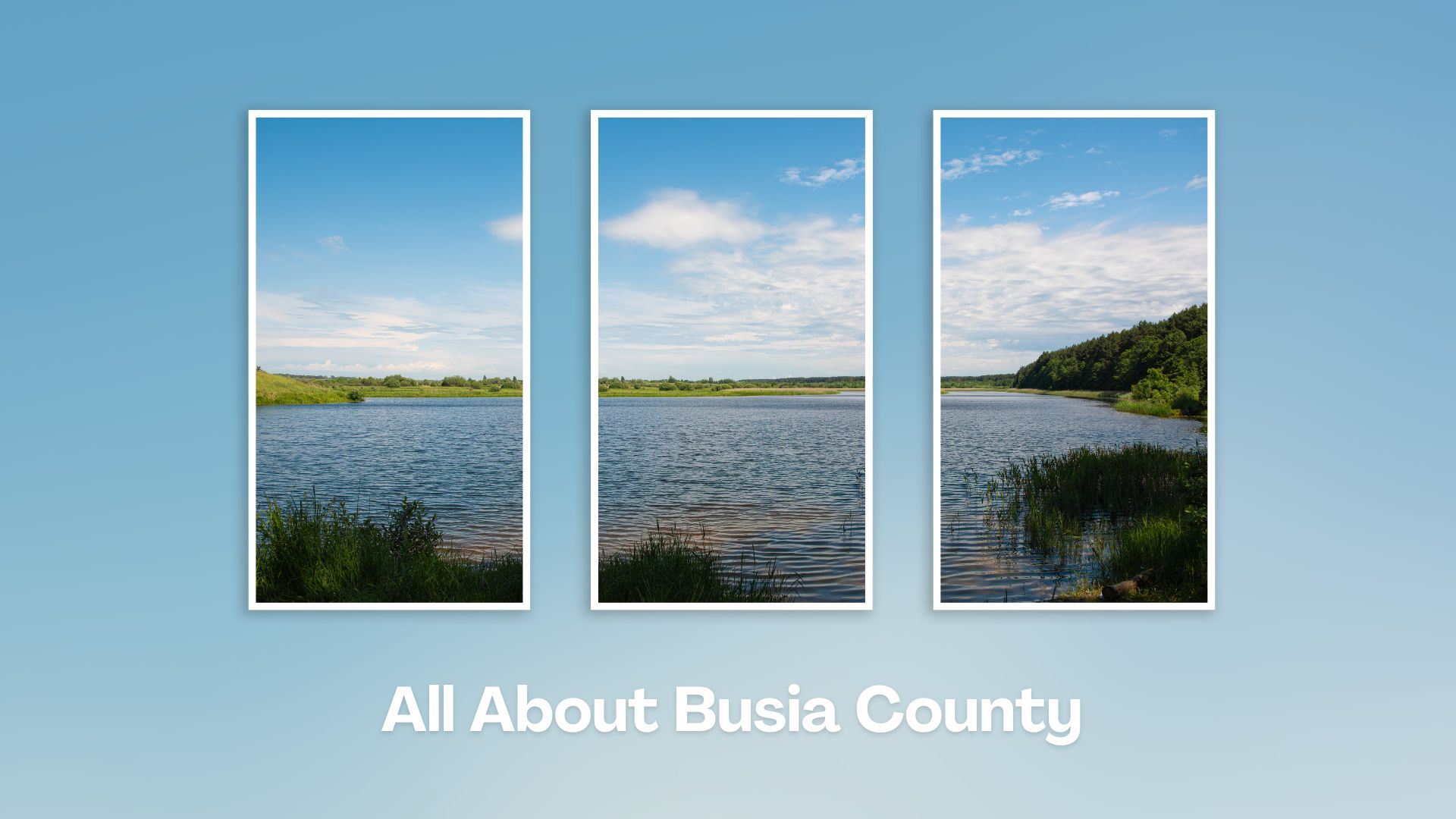


Enjoy the warm hospitality of the people of Busia County while exploring its diverse attractions. Busia County offers a blend of cultural experiences, natural beauty, and historical sites. Visit the lakeshore to enjoy serene views, take boat rides, and possibly visit fishing communities to learn about their way of life.
A Guide to Busia County


A Summa Digest of Busia

About Busia Way Back When

22 Destinations in Busia County, arranged as one would visit these - east, south then north - with the aid of narratives, images, strip maps and distance chart:

Sio Port, Samia Hills, Bakhulo Shrines in Samia, Budalang'i Forest, Port Victoria, Namenya Hills, Marenga Beach, Muhondo Conservancy, Budalang'i Delta, Che's Bay Resort, Bunyala Rice Scheme, River Nzoia, Yala Swamp, Sio Siteki Swamp, Kavirondo Rocks, Emakina Hills, Alupe Leprosy Center, Busia Border Point, Kocholia Irrigation Scheme, Kakapel Rock, Kakapel Cultural Centre, Malaba Sanctuary

Know More About Busia County: Its Geography, Land-Use, Highlights, Population, Roads - including strip maps, Airports, Climate and National Monuments
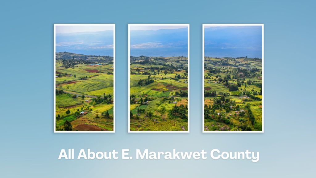
Touring Elgeyo Marakwet County in Kenya offers a mix of stunning landscapes, cultural experiences, and outdoor adventures. Renowned for its rugged terrain and picturesque landscapes, it is also home to globally-famous long distance running exports. Hiking enthusiasts can explore trails such as the famous Kerio Valley Escarpment or venture into the Cherangani Hills for more challenging hikes.
A Guide to Elgeyo Marakwet County


A Summa Digest of Elgeyo Marakwet

About Elgeyo Marakwet Way Back When

44 Destinations in E. Marakwet County, arranged as one would visit these - west, south then north - with aid of narratives, images, strip maps and distance chart:

Home of Champions Art Center, Keiyo Gardens, High Altitude Training Camp, Kamariny Stadium, St. Patrick's High School, Bugar Forest, Iten Viewpoint, Lelin Campsite, Kerio View Hotel, Active Edge, Rimoi National Reserve, Kapkurmoi Cultural & Conservation, Kessup Falls, Kessup Forest, Kilima Resort, Tambach Museum, Kolol Viewpoint, Torok Falls, Biretwo Museum, Kerio River Lodge, Chebloch Gorge, Samich Resort, Kenya Fluorspar Company, Sego Safari Resort, Melwa Gorge, Kerio Valley, Elgeyo (Kerio) Escarpment, Lake Kamnarok National Reserve, Kureswo Hot Springs, Metkei Ridge, Chemonde Forest, Chebirara Falls, Mela Cave, Cherangani Hills, Teren River Bridge, Arror Dam, Chebara Dam, Embobut Forest, Wewo Catholic Church, The Foothills (Kipkunurr & Koisungur), Kipteberr Hill, Kiplagoch Caves, Ancient Marakwet Furrows

Know More About E. Marakwet County: Its Geography, Land-Use, Highlights, Population, Roads - including strip maps, Airports, Climate & National Monuments
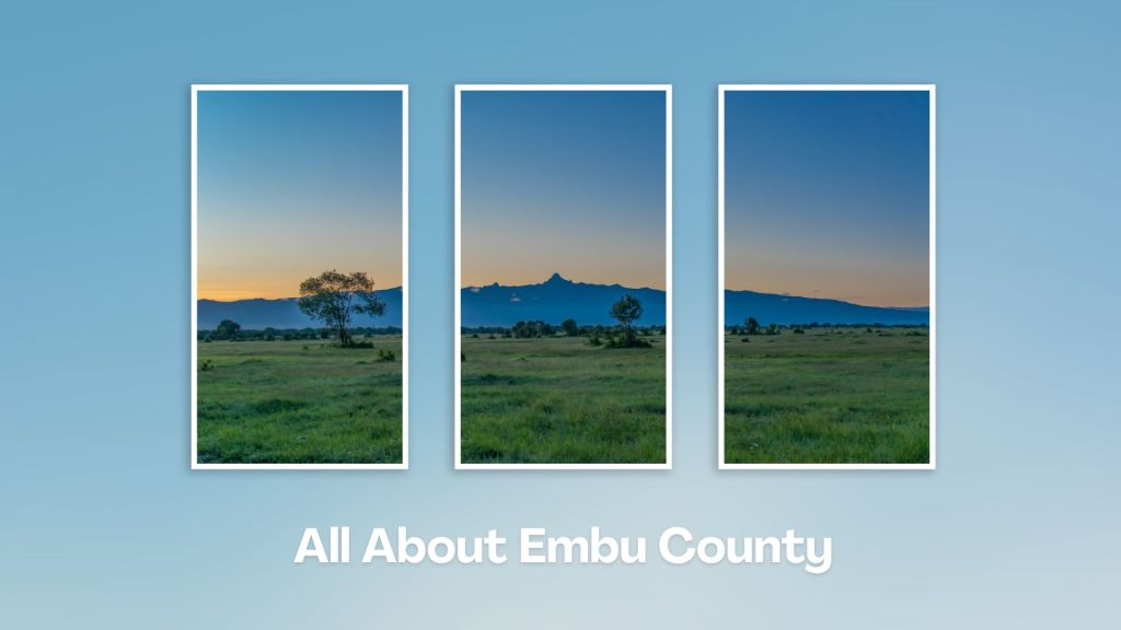
Situated at the base of Mount Kenya, Embu County offers a rich tapestry of cultural heritage, natural beauty, and adventure activities, making it a rewarding destination for travelers seeking an authentic experience in the central highland of Kenya. Engage with the Aembu and Mbeere people, who inhabit the region, and learn about their traditional way of life, like farming practices, music, and dance.
A Guide to Embu County


A Summa Digest of Embu

About Embu Way Back When

32 Destinations in Embu County, arranged as one would visit these - south, west, east then south - with the aid of narratives, images, strip maps and distance chart:

Mwea Rice Plains, Ndaraca ya Ngai, Embu Art Centre, Izaak Walton Inn, Iveche Falls, Karunina Falls, Njukiri Forest, Camp Ndunda Falls, Mount Kenya Riverside Retreat, Embu Golf Range, Murinduko Hill Forest, Karue Hill, Kirimiri Forest, Nthenge Njeru Falls, Nthungu Falls, Nthenge Njeru Hiking Trail, Irangi Forest Station, Mzima Fishing Camp, Kaagari-Gaturi Irrigation, Thuci River Lodge, Mbeere Terraces, Kiang’ombe Forest, Mumoni Hill, Kianjiru Hill, Mwea National Reserve, Kamburu Dam, Riakanau Beach, Masinga Dam, Masinga Dam Resort, Gitaru Dam, Kindaruma Dam, Kiambere Dam

Know More About Embu County: Its Geography, Land-Use, Highlights, Population, Roads - with aid of strip maps, Airports, Climate & National Monuments

Touring Garissa County offers a unique blend of cultural immersion, natural beauty, and opportunities to explore the traditional way of life in northeastern Kenya, unchanged since the days of yore. It’s a chance to experience authentic Somali culture and hospitality while enjoying the serene beauty of northeastern.
A Guide to Garissa County


A Summa Digest of Garissa

About Garissa Way Back When

18 Destinations in Garissa County, arranged as one would visit these - west, north, east then south - with aid of narratives, images, strip maps and distance chart:

River Tana, Almond Resort, Suuq Mugdi Market, Jamia Mosque Garissa, Garissa Culture and Heritage Center, Garissa Giraffe Centre, Garissa Solar Power Plant, Bour-Algi Giraffe Sanctuary, Rahole National Reserve, Merti Plains, River Ewaso Nyiro, Lorian Swamp, Dadaab Camp, Arawale National Reserve, Ishaqbini Hirola Community Conservancy, Lake Ishaqbini, Boni Forest National Reserve, Lag Badana Reserve

Know More About Garissa County: Its Geography, Land-Use, Highlights, Population, Roads - including a distance chart, Airports, Climate & National Monuments

Located in the western Kenya, bordering Lake Victoria, Homa Bay County is known for its scenic landscapes, extensive lakeshore, and vibrant community life. It also offers a rich blend of cultural and historical attractions. Touring Homa Bay County allows you to immerse yourself in a part of Kenya’s natural beauty, cultural diversity, and immersive historical heritage that rarely gets under the limelight.
A Guide to Homa Bay County


A Summa Digest of Homa Bay

About Homa Bay Way Back When

48 Destinations in Homa Bay County, arranged as one would visit these - southeast, north then west - with aid of narratives, strip maps and distance chart:

Sondu Miriu Hydro Station, Old Kendu Bay Town, Olmak Beah Resort, Kendu Adventist Gendia, Lake Simbi Nyaima, Ondago Swamp National Sanctuary, Kisindi Lodge and Spa, Homa Hills, Abundu Hot Springs, Bala Lawi Hot Springs, Kanjera Prehistoric Site, Kanam Prehistoric Site, Asego and Kasarua Hills, Homa Bay Town, Asumbi Catholic Church, Asumbi Resort, Kodera Forest, Ruri Hills, Soklo Kipenji, BJs Ranch, Mbita Point, Victoria Sands Lodge, Gembe Hills, Mbita Ferry, Rusinga Island, Rusinga Island Lodge, Tom Mboya Mausoleum, White Stone Beach Resort, Rusinga Island Festival, Ngodhe Island, Kasawanga Village, Mfangano Island, Mfangano Island Lodge, Mawanga Rock Art, Kwitone Rock Art, Abasuba Peace Museum, Siambi Resort, Takawiri Island, Ringiti Island, Mbasa Islands, Gwassi Hills, Lambwe Valley, Ruma National Park, KWS Obiri Guest House, Kanyamwa Escarpment, Nyamugondho Shrine, Gor Mahia Shrine

Know More About Homa Bay County: Its Geography, Land-Use, Highlights, Population, Roads - including a distance chart, Airports, Climate & National Monuments
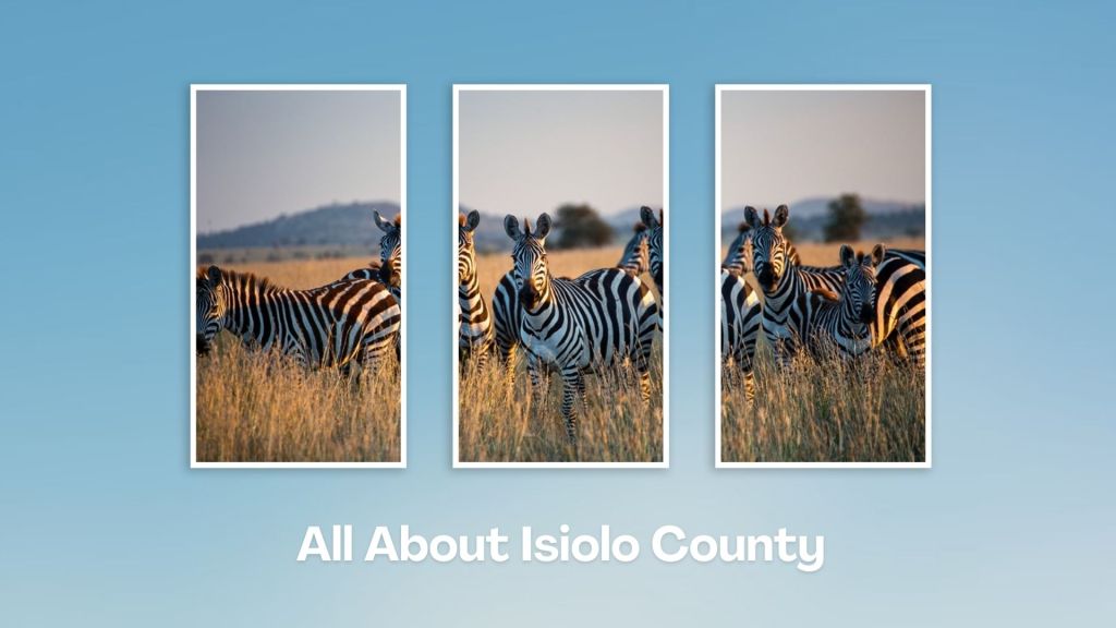
Isiolo County, with its strategic location, rich cultural heritage, and potential for development, is a unique region in Kenya. It features a mix of semi-arid and arid landscapes, with some areas of savannah and bushland, and home to several wildlife reserves and conservancies, including the Buffalo Springs National Reserve, Shaba National Reserve and the famed Lewa Wildlife Conservancy.
A Guide to Isiolo County


A Summa Digest of Isiolo

About Isiolo Way Back When

42 Destinations in Isiolo County, arranged as one would visit these - south, north, east then north - with aid of narratives, images, strip maps and distance chart:

Isiolo Town, St. Eusebius Cathedral, Isiolo Jamia Mosque, Isiolo Memorial, Kisimani Eco Resort, Isiolo Falls, Kaita and Degushi Hills, Nyambeni Range, Magado Crater, Cave Dwellings, Harr Girrissa, Mlima Tatu, Kubi Turkana, Garba Tula, Gotu Falls, Gotu Cultural Centre, Biliqo Bulesa Conservancy, Merti Plateau, Merti Catholic Church, Ewaso Nyiro River, Lorian Swamp, Malka Cultural Centre, Bisanadi National Reserve, Kora Wells, Leparua Conservancy, Ol Lentille Conservancy, The Sanctuary at Ol Lentille, Oldonyiro Conservancy, Nantudu Spire Rock, Nasuulu Conservancy, Buffalo Springs National Reserve, Buffalo Springs, Samburu National Reserve, Samburu Simba Lodge, Shaba National Reserve, Sarova Shaba Lodge, Joy’s Camp, Nakuprat Gotu Conservancy, Boji Dera Camp, Sera Conservancy, Isiolo Cultural Festival, Camping in the Great North

Know More About Isiolo County: Its Geography, Land-Use, Highlights, Population, Roads - with the aid of strip maps, Airports, Climate & National Monuments

Touring Kilifi County offers a delightful blend of coastal beauty, lovely beaches, cultural richness, natural wonders, and fascinating ancient ruins. Whether you’re seeking pristine beaches, historical sites, or vibrant cultural experiences – or a combination, Kilifi promises a memorable and enriching travel experience.
A Guide to Kilifi County


A Summa Digest of Kilifi

About Kilifi Way Back When

95 Destinations in Kilifi County, arranged as one would visit these - south, north, east then north - with aid of narratives, images, strip maps and distance chart:

Shimo la Tewa Prison, Mtwapa Creek, Mtwapa Ruins, The Moorings, La Marina Restaurant, Jumba la Mtwana, Kikambala Beach, Vipingo Mosque Ruins, Kinuni Ruins, Kuruwitu Conservancy, Neem Tree House, Vipingo Ridge, Chasimba Cave, Kilifi Sisal Plantations, Vuma Cliffs, Old Town Takaungu, Takaungu Creek, Kitoka Ruins, Takaungu House, Beneath the Baobab Festival, Kilifi Creek, Kilifi Bridge, Kilifi Boatyard, Distant Relatives Lodge, Mnarani Ruins, Mnarani Snake Park, 3 Degrees South, Kamili House, Mazingira Park, Bofa Beach, Saltys Kitesurfing Bar & Restaurant, Bush Baby Kilifi, Casa Dalton, Panga ya Saidi Cave, River Rare Geo Park, Arabuko-Sokoke Forest, Mwangea Hills Forest, Watamu Marine National Park, Uyombo Ruins, Rock & Sea Resort, Mida Creek, Sudi Island, Kirepwe Ruins, Watamu Beach, Ocean Sports Watamu, Medina Palms, Hemimways Watamu, A Rocha Eco Lodge & Conservation Centre, Watamu Treehouse, Garoda Beach, Tribe Watersports, Kite House, Local Ocean Conservation, Bio-Ken Snake Farm, Kiburugeni Ruins, Mgangani Ruins, Mida Creek Nature Camp, Gede Ruins, Kipepeo Butterfly Farm, Malindi Museum, Henry the Navigator Monument, Malindi Pier, Malindi Pillar Tomb, Malindi Waterfront Park, Portuguese Chapel, Vasco da Gama Pillar, Malindi Beach, Ndoro Sculpture Garden, White Elephant Sea & Art Lodge, Malindi Crocodile & Snake Farm, Malindi Marine National Park, Malaika Beach Sunbeds & Restaurant, Sawa Sawa Dhow Excursions, Lo Sfizio Coffee Shop, Lennox Art Gallery, Falconry of Kenya, Hanging Gardens, Malindi Golf & Country Club, River Sabaki Delta, Marafa Depression, Dakacha Woodland, Mekatilili wa Menza Site, Mambrui Dunes, Mambrui, Mambrui Tombs, Kibirakani Ruins, Che Shale Hotel Kitesurf Center, Ngomeni Shipwreck, Luigi Broglio Space Centre, The Nyika Plateau, Galana Conservancy, Ngala Mausoleum, Rabai Museum, Kaya Kambe Shrine, Thomas Wakefield Memorial Church

Know More About Kilifi County: Its Geography, Land-Use, Highlights, Population, Roads - including strip maps, Airports, Climate & National Monuments

Kisii County is a vibrant region with a strong agrarian base, rich cultural heritage, and a growing economy. Continued development in infrastructure, with smooth blacktop connecting major towns and rural areas, has made it accessible from all directions. Kisii County’s scenic hills, waterfalls, cottage industries and modern hotels offer opportunities for visiting a region erstwhile relegated as agrarian.
A Guide to Kisii County County


A Summa Digest of Kisii

About Kisii Way Back When

16 Destinations in Kisii County, arranged as one would visit these - southeast, west then north - with aid of narratives, images, strip maps and distance chart:

Masabo Hill, Keroka Landscape, Nyakwana Falls, Lake Okari, Nyamarambe Falls, Gucha River, Manga Hills, Itibo Resort, Nyanchwa Hill, Sameta Hill, Kisii Boma Cemetery, Kisii Golf Club, Kamel Park Hotel, Tabaka Soapstone Industry, Nyangweta Forest, Tara Site

Know More About Nyamira County: Its Geography, Land-Use, Highlights, Population, Roads - including a distance chart, Airports, Climate & National Monuments
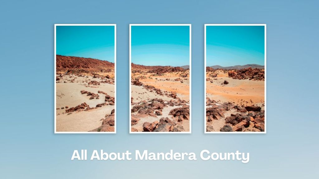
Mandera County, in northeastern Kenya, sharing borders with Ethiopia to the north and Somalia to the east, is a place of unique geographical features, cultural diversity, and unique socio-economic activities. Its obscurity stems from the facts that it is a semi-arid block, with rampant insecurity, and limited infrastructure development. Even so, Mandera County harbours many little-known surprises!
A Guide to Mandera County


A Summa Digest of Mandera

About Mandera Way Back When

8 Destinations in Mandera County, arranged as one would visit these - south, north then west - with the aid of in-depth narratives, images, strip maps and distance chart:

El Wak Ancient Wells, Fort El Wak, Marehan Sandstone, Malka Mari National Park, River Daua, Dandu Hills, Red Sea Resort, Mandera Town

Know More About Mandera County: Its Geography, Land-Use, Highlights, Population, Roads - including strip maps, Airports, Climate & National Monuments

Touring Nyamira County offers a glimpse into the natural heritage of western Kenya, and cultural encounter with the charismatic Abagusii community. At Keroka, Otenyo Cultural Group Center offers insights into their traditions and customs. Generally speaking, Nyamira County is agrarian, typified by rolling hills.
A Guide to Nyamira County


A Summa Digest of Nyamira

About Nyamira Way Back When

18 Destinations in Nyamira County, arranged as one would visit these - southeast, west then north - with aid of narratives, images, strip maps and distance chart:

Amanzi Resort, Kibugat Hill, Kipkebe Tea Estate, The Henri Boma, Eyaka Falls, Nyakwana [Keera] Falls, Kegogi Market, Nyamira Falls, Nkoora Hill, Bonyunyu Dam, Keroka, Otenyo Cultural Group Center, Manga Ridge, Otenyo Nyamaterere Shrine, Manga Hills, River Gucha, Kiabonyoru Hill, Chabera Coffee Factory, River Sondu Bridge

Know More About Nyamira County: Its Geography, Land-Use, Highlights, Population, Roads - including a distance chart, Airports, Climate & National Monuments

Tana River County is a rewarding destination for travelers interested in exploring off-the-beaten-path locations in Kenya. River Tana is the longest river in Kenya, flowing through the county and offering opportunities for riverine activities such as boat cruises, fishing, and birdwatching. Tana River County is home to the Orma and Pokomo ethnic groups, each with rich cultural traditions, music, and dances.
A Guide to Tana River County


A Summa Digest of Tana River

About Tana River Way Back When

28 Destinations in Tana River County, arranged as one would visit these - north to south - with the aid of narratives, images, strip maps and distance chart:

Ngao Neukirchen Church, Lake Shakababo, Delta Dunes Lodge, Ozi Conservation Area, Tana River Lodge, Old Town Kipini, Ungwana Bay Ruins, Shaka Ruins, Mwana Ruins, Fumo Liyongo Shrine, Kipini Conservancy, Red Cliff Camp, River Tana Delta, Tana Delta Colonial Forts, Tana Delta Cultural Centre, Tana Primate National Reserve, Mchelelo Bandas, Ndera Conservancy, Mau Mau Hola Monument, Hola Methodist Church, Bura St. Jude, Bura Irrigation Scheme, Bura East Conservancy, Arawale National Reserve, George Adamson's Grave, Kora National Park, Adamson's Fall, Tana River Bridge

Know More About Tana River County: Its Geography, Land-Use, Highlights, Population, Roads - including a distance chart, Airports, Climate & National Monuments
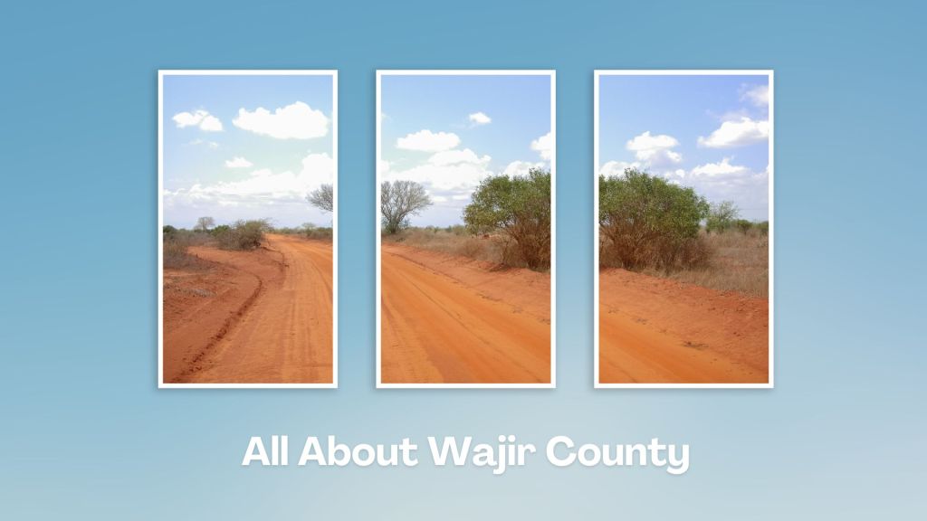
Wajir County offers a unique opportunity to explore a region known for its rich cultural heritage and unique landscapes. Its arid and semi-arid landscapes, including vast plains, rocky outcrops, and seasonal rivers, harbours plenty of wildlife adapted to arid conditions. Wajir County is a region shaped by its cultural heritage, resilience in harsh environments, and the traditions of its pastoralists.
A Guide to Wajir County


A Summa Digest of Wajir

About Wajir Way Back When

20 Destinations in Wajir County, arranged as one would visit these - north, west then south - with the aid of narratives, images, strip maps and distance chart:

Wajir Oasis Hotel, Lake Yahud, Wagalla Monument, Old Wajir Town, Orahey Wells, Orahey Bunkers, Fort Wajir, Wajir Museum, Wajir War Cemetery, Esspresso Royale, Wajir Livestock Market, Wajir Giraffe Sanctuary, Shaletey Caves, Grosso Griftu, Malabar Hill, Mansa Guda Formation, Sabuli Wildlife Conservancy, Sabena Desert, Lorian Swamp, Habaswein

Know More About Wajir County: Its Geography, Land-Use, Highlights, Population, Roads - including a distance chart, Airports, Climate & National Monuments

Touring West Pokot County in Kenya offers a chance to explore a region known for its iconic, rugged landscapes, vibrant cultures, and rich traditions. Located in the extreme northwest part of the country, bordering Uganda, West Pokot County is primary inhabited by the Pokot community, known for their pastoralist lifestyle.
A Guide to West Pokot County


A Summa Digest of West Pokot

About West Pokot Way Back When

32 Destinations in West Pokot County, arranged as one would visit these - south to northeast - with the aid of narratives, images, strip maps and distance chart:

Kaisagat Viewpoint, Barnley's Guest House, Kapkoris Hill Viewpoint, Dini ya Roho Church, Mount Murpus, Chewoyet High School, Kapenguria Museum, Kapenguria Town, Chelanga Gardens, Tartar Falls, Kacheliba, Holy Cross Church Kacheliba, Alale Gold Mines, Suam River Beach, Kamatira Forest, Lounon Village, Cherangani Hills, Marich Pass, Marich Pass Center, Kang'alan Escarpment, Kolloa Cross Monument, Weiwei Irrigation Scheme, Tamkal Valley, Mount Koh, Sekerr Range, Mount Mtelo View Lodge, Nasolot National Reserve, Turkwel Dam, Turkwel Gorge, State Lodge, Riting

Know More About West Pokot County: Geography, Land-Use, Highlights, Population, Roads - including a distance chart, Airports, Climate & National Monuments
